
Population 4,242 (2011 census) Postal code 4810 | Postcode(s) 4810 | |
 | ||
West End is one of the older suburbs of Townsville, Queensland, Australia. In the 2011 census, West End had a population of 4,242 people.
Contents
Map of West End QLD 4810, Australia
Geography
West End is situated at the base of Castle Hill (the hill).
History
The first community cemetery is located in West End. A reflection of attitudes existing during the time it was in use, research has established that it was ethnically segregated. It has been reported that there are separate areas where, at least, Chinese and Aboriginal deceased were interred.
During World War 2, the massive Green Street bunker was used by the RAAF. It is now the State Emergency Service building.
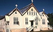
Heritage listings
West End has a number of heritage-listed sites, including:
References
West End, Queensland (Townsville) Wikipedia(Text) CC BY-SA