
Postcode(s) 5008 Postal code 5008 | Local time Saturday 8:48 AM | |
 | ||
Weather 14°C, Wind S at 13 km/h, 81% Humidity | ||
West Croydon is a suburb in the north-west of Adelaide, South Australia.
Contents
Map of West Croydon SA 5008, Australia
West Croydon has a population of 3881, ABS Census 2006, and is located 5 km west of the Central Business District of Adelaide. The population has changed greatly over the past 15 years as older residents move away and younger residents move in. The main industry is Glass Manufacturing with ACI being one of the largest plants of its type in the Southern Hemisphere.
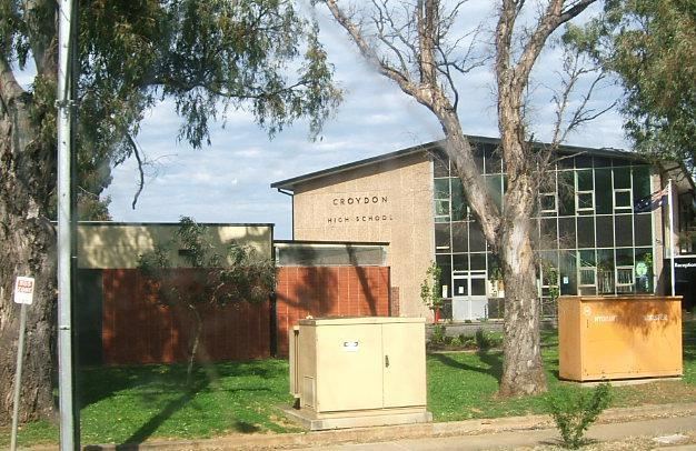
Croydon High School closed at the end of 2006 due to falling enrolments. The site is currently occupied by the School of Languages and the Adelaide Secondary School of English. The Islamic College of South Australia is also located in West Croydon.
The Suburb is within the Federal seat of Port Adelaide and the City of Charles Sturt. Until the early 1920s the suburb was a farming area with infill occurring until the 1970s.
History
West Croydon transformed from mostly farmland into a suburb in 1925 when the Shillabeer family sold a large portion of East View Farm (established in 1840). In 1944 the Shillabeer farm homestead was purchased by the state government and became the Croydon Technical High School, which later changed name to Croydon High School. Adelaide Secondary School of English moved to the site in 1998.
The first Allenby Gardens Post Office was renamed West Croydon on 1 March 1945 and closed in 1971.