
Country United States Incorporated April 6, 1846 Founded 6 April 1846 Population 2,383 (2000) | Elevation 315 ft (96 m) Local time Monday 3:13 AM | |
 | ||
Area rank 129th of 566 in state12th of 26 in county Weather 6°C, Wind NE at 2 km/h, 73% Humidity Points of interest Washington Crossing Historic P, Delaware and Raritan C, South County Park | ||
West Amwell Township is a township in Hunterdon County, New Jersey, United States. As of the 2010 United States Census, the township's population was 3,840, reflecting an increase of 1,457 (+61.1%) from the 2,383 counted in the 2000 Census, which had in turn increased by 132 (+5.9%) from the 2,251 counted in the 1990 Census.
Contents
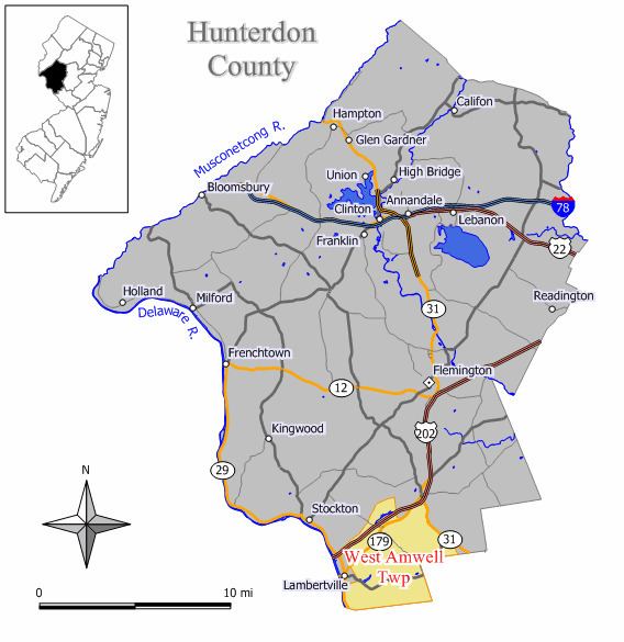
- Map of West Amwell Township NJ USA
- Geography
- Census 2010
- Census 2000
- Local government
- Federal state and county representation
- Politics
- Education
- Roads and highways
- Public transportation
- References
Map of West Amwell Township, NJ, USA
West Amwell was incorporated as a township by an act of the New Jersey Legislature on April 6, 1846, when Amwell Township was split, also creating East Amwell Township at the same time. Portions of the township were taken to form Lambertville town on March 1, 1849. In 1896, the township annexed portions of Delaware Township, East Amwell Township and Raritan Township. The township was named for Amwell Township, which in turn was named for Amwell, Hertfordshire in England.
The Delaware Native Americans had a path through the woods from Lambertville through Mount Airy, Ringoes and Reaville to Newark upon which the Old York Road was subsequently laid.
Geography
The northern areas of West Amwell are in Amwell Valley, while the southern sections are in The Sourlands region. The Delaware River separates West Amwell from the Commonwealth of Pennsylvania.
According to the United States Census Bureau, the township had a total area of 21.776 square miles (56.398 km2), including 21.581 square miles (55.894 km2) of land and 0.195 square miles (0.505 km2) of water (0.89%).
The township borders Alexandria Township, Bethlehem Township, Clinton, Clinton Township, Franklin Township and Lebanon Township.
Unincorporated communities, localities and place names located partially or completely within the township include Alexauken, Bowlryville, Bowne, Linvale, Mount Airy, Oakdale and Rocktown.
Census 2010
As of the census of 2010, there were 3,840 people, 1,102 households, and 838.6 families residing in the township. The population density was 177.9 per square mile (68.7/km2). There were 1,157 housing units at an average density of 53.6 per square mile (20.7/km2). The racial makeup of the township was 82.58% (3,171) White, 13.39% (514) Black or African American, 0.05% (2) Native American, 1.46% (56) Asian, 0.05% (2) Pacific Islander, 1.12% (43) from other races, and 1.35% (52) from two or more races. Hispanic or Latino of any race were 4.84% (186) of the population.
There were 1,102 households out of which 30.9% had children under the age of 18 living with them, 66.9% were married couples living together, 5.2% had a female householder with no husband present, and 23.9% were non-families. 19.5% of all households were made up of individuals, and 9.2% had someone living alone who was 65 years of age or older. The average household size was 2.58 and the average family size was 2.95.
In the township, the population was spread out with 16.5% under the age of 18, 11.8% from 18 to 24, 30.1% from 25 to 44, 30.2% from 45 to 64, and 11.4% who were 65 years of age or older. The median age was 40.8 years. For every 100 females there were 155.1 males. For every 100 females ages 18 and old there were 165.5 males.
The Census Bureau's 2006-2010 American Community Survey showed that (in 2010 inflation-adjusted dollars) median household income was $101,094 (with a margin of error of +/- $16,403) and the median family income was $115,595 (+/- $19,328). Males had a median income of $86,875 (+/- $26,080) versus $53,438 (+/- $17,350) for females. The per capita income for the borough was $54,485 (+/- $9,741). About 4.2% of families and 4.4% of the population were below the poverty line, including 3.2% of those under age 18 and 4.9% of those age 65 or over.
Census 2000
As of the 2000 United States Census there were 2,383 people, 949 households, and 696 families residing in the township. The population density was 109.7 people per square mile (42.4/km²). There were 984 housing units at an average density of 45.3 per square mile (17.5/km²). The racial makeup of the township was 98.07% White, 0.63% African American, 0.08% Native American, 0.71% Asian, 0.04% from other races, and 0.46% from two or more races. Hispanic or Latino of any race were 0.71% of the population.
There were 949 households out of which 29.1% had children under the age of 18 living with them, 65.3% were married couples living together, 5.1% had a female householder with no husband present, and 26.6% were non-families. 21.3% of all households were made up of individuals and 8.7% had someone living alone who was 65 years of age or older. The average household size was 2.51 and the average family size was 2.93.
In the township the population was spread out with 21.1% under the age of 18, 4.5% from 18 to 24, 28.3% from 25 to 44, 32.1% from 45 to 64, and 13.8% who were 65 years of age or older. The median age was 43 years. For every 100 females there were 100.3 males. For every 100 females age 18 and over, there were 101.2 males.
The median income for a household in the township was $73,380, and the median income for a family was $79,605. Males had a median income of $49,539 versus $33,333 for females. The per capita income for the township was $33,877. About 0.6% of families and 1.6% of the population were below the poverty line, including none of those under age 18 and 1.2% of those age 65 or over.
Local government
West Amwell Township is governed under the Township form of government. The governing body is a three-member Township Committee, whose members are elected directly by the voters at-large in partisan elections to serve three-year terms of office on a staggered basis, with either one or two seats coming up for election each year as part of the November general election in a three-year cycle. At an annual reorganization meeting, the Township Committee selects one of its members to serve as Mayor and another as Deputy Mayor.
As of 2016, members of the West Amwell Township Committee are Mayor Zachary T. Rich (R, term on committee and as mayor ends December 31, 2016), Deputy Mayor John C. Dale (R, term on committee ends 2017; term as deputy mayor ends 2016) and Bergenfeld (R, 2018).
After voters passed a non-binding referendum in November 2014 supporting the expansion of the Township Committee from three to five members, the Township Committee addressed the process of following through with the expansion, which would involve gathering petitions of 147 voters after which the committee could approve the expansion or a bing referendum could be put on the ballot.
Federal, state and county representation
West Amwell Township is located in the 7th Congressional District and is part of New Jersey's 15th state legislative district. Prior to the 2011 reapportionment following the 2010 Census, West Amwell Township had been in the 23rd state legislative district. Prior to the 2010 Census, West Amwell Township had been part of the 12th Congressional District, a change made by the New Jersey Redistricting Commission that took effect in January 2013, based on the results of the November 2012 general elections.
New Jersey's Seventh Congressional District is represented by Leonard Lance (R, Clinton Township). New Jersey is represented in the United States Senate by Cory Booker (D, Newark, term ends 2021) and Bob Menendez (D, Paramus, 2019).
For the 2016–2017 session (Senate, General Assembly), the 15th Legislative District of the New Jersey Legislature is represented in the State Senate by Shirley Turner (D, Lawrence Township, Mercer County) and in the General Assembly by Reed Gusciora (D, Trenton) and Elizabeth Maher Muoio (D, Pennington). The Governor of New Jersey is Chris Christie (R, Mendham Township). The Lieutenant Governor of New Jersey is Kim Guadagno (R, Monmouth Beach).
Hunterdon County is governed by a five-member Board of Chosen Freeholders, who serve three-year terms of office at-large on a staggered basis, with either one or two seats up for election each year on a partisan basis as part of the November general election. At an annual reorganization meeting held each January, the freeholders select one member to serve as the board's Director and another to serve as Deputy Director. As of 2015, Hunterdon County's Freeholders are Freeholder Director John King (R; Raritan Township, 2015), Freeholder Deputy Director Suzanne Lagay (R; Holland Township, 2016), J. Matthew Holt (R; Clinton Town, 2015), John E. Lanza (R; Flemington, 2016) and Robert G. Walton (R; Hampton, 2017). Constitutional officers elected on a countywide basis are County Clerk Mary H. Melfi (R; Flemington, 2017), Sheriff Fredrick W. Brown (R; Alexandria Township, 2016) and Surrogate Susan J. Hoffman (R; Kingwood Township, 2018).
Politics
As of March 23, 2011, there were a total of 2,071 registered voters in West Amwell Township, of which 498 (24.0%) were registered as Democrats, 830 (40.1%) were registered as Republicans and 741 (35.8%) were registered as Unaffiliated. There were 2 voters registered to other parties.
In the 2012 presidential election, Republican Mitt Romney received 52.3% of the vote (827 cast), ahead of Democrat Barack Obama with 46.4% (733 votes), and other candidates with 1.3% (20 votes), among the 1,587 ballots cast by the township's 2,178 registered voters (7 ballots were spoiled), for a turnout of 72.9%. In the 2008 presidential election, Republican John McCain received 50.8% of the vote (878 cast), ahead of Democrat Barack Obama with 47.1% (814 votes) and other candidates with 1.4% (24 votes), among the 1,730 ballots cast by the township's 2,101 registered voters, for a turnout of 82.3%. In the 2004 presidential election, Republican George W. Bush received 55.6% of the vote (899 ballots cast), outpolling Democrat John Kerry with 43.2% (698 votes) and other candidates with 1.1% (22 votes), among the 1,616 ballots cast by the township's 1,940 registered voters, for a turnout percentage of 83.3.
In the 2013 gubernatorial election, Republican Chris Christie received 70.9% of the vote (675 cast), ahead of Democrat Barbara Buono with 26.2% (249 votes), and other candidates with 2.9% (28 votes), among the 979 ballots cast by the township's 2,149 registered voters (27 ballots were spoiled), for a turnout of 45.6%. In the 2009 gubernatorial election, Republican Chris Christie received 56.7% of the vote (764 ballots cast), ahead of Democrat Jon Corzine with 34.3% (462 votes), Independent Chris Daggett with 6.6% (89 votes) and other candidates with 0.4% (6 votes), among the 1,348 ballots cast by the township's 2,074 registered voters, yielding a 65.0% turnout.
Education
The South Hunterdon Regional School District serves students in pre-kindergarten through twelfth grade from Lambertville, Stockton and West Amwell Township. Each of the three municipalities have their own school through sixth grade; public school students in seventh through twelfth grades attend a shared high school in Lambertville. As of the 2014-15 school year, the district and its four schools had an enrollment of 961 students and 94.7 classroom teachers (on an FTE basis), for a student–teacher ratio of 10.1:1. Schools in the district (with 2014-15 enrollment data from the National Center for Education Statistics) are Lambertville Public School (244 students; grades PreK-6), Stockton Borough School (grades 2-6), West Amwell School (grades K-6) and South Hunterdon Regional High School (grades 9-12).
In a special election held in September 2013, voters from Lambertville, Stockton and West Amwell Township passed referenda to dissolve the South Hunterdon Regional High School District and to combine the three existing school districts from each municipality (Lambertville City School District, Stockton Borough School District and West Amwell Township School District), with majorities in each community passing both ballot items. A single combined regional district was created, serving students in pre-kindergarten through twelfth grade, in which property taxes are levied under a formula in which 57% is based on property values and 43% on the number of students. The executive county superintendent appointed an interim board of education for the new regional district, which was responsible for implementing the merger.
Roads and highways
As of May 2010, the township had a total of 56.52 miles (90.96 km) of roadways, of which 37.75 miles (60.75 km) were maintained by the municipality, 8.43 miles (13.57 km) by Hunterdon County and 10.34 miles (16.64 km) by the New Jersey Department of Transportation.
Route 29 passes through the southwestern part of the municipality, but without any roads that connect to the heart of the township. Route 31 passes along the eastern border with East Amwell. Route 179 and U.S. Route 202 pass though around the northwestern part of the municipality. Two major county roads that go through are CR 518 and CR 579. The closest limited access road is Interstate 95 which is outside the township in neighboring Hopewell.
Public transportation
NJ Transit offers bus service to Trenton on the 608 route.