
Country United States County Hunterdon Area 73.97 km² Population 4,455 (2000) | Incorporated April 6, 1846 Elevation 75 m Local time Thursday 9:52 PM | |
 | ||
Area rank 94th of 566 in state8th of 26 in county Weather 9°C, Wind N at 13 km/h, 35% Humidity | ||
East Amwell Township is a township in Hunterdon County, New Jersey, United States. As of the 2010 United States Census, the township's population was 4,013, reflecting a decline of 442 (-9.9%) from the 4,455 counted in the 2000 Census, which had in turn increased by 123 (+2.8%) from the 4,332 counted in the 1990 Census.
Contents
- Map of East Amwell Township NJ USA
- History
- Geography
- Census 2010
- Census 2000
- Local government
- Federal state and county representation
- Politics
- Education
- Transportation
- Wineries
- Notable people
- References
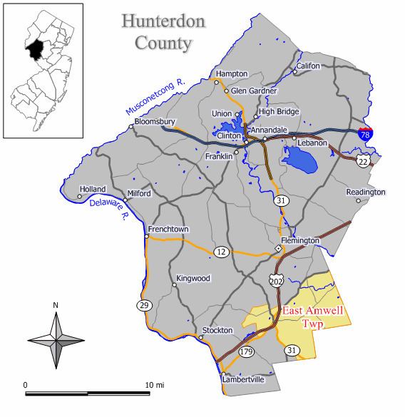
Map of East Amwell Township, NJ, USA
East Amwell Township is located in the southeastern corner of Hunterdon County where it borders both Somerset and Mercer counties. It includes the unincorporated community of Ringoes, the oldest known settlement in Hunterdon County, as well as the communities of Larison's Corner, Weert's Corner and part of Reaville.
History
Amwell Township was established by a royal patent from Queen Anne in 1708. Its territory comprised 200 square miles (520 km2) and included present day Delaware Township, Raritan Township, Readington Township, East Amwell Township and West Amwell Township and portions of Clinton, Lebanon and Tewksbury Townships. Both East Amwell Township and West Amwell Township were formed on April 6, 1846, when Amwell Township was split in two. Territory was gain in 1854 from Delaware Township, Raritan Township and West Amwell Township, and again from those same three townships in 1897. The township was named for Amwell Township, which in turn was named for Amwell, Hertfordshire in England.
During the American Revolutionary War, a small but important skirmish occurred in East Amwell when local militia under Capt. John Schenck ambushed a party of British dragoons near Larison's Corner. The "Ambush of Geary" on December 14, 1776, helped rein in British scouting parties in Hunterdon County in the crucial weeks before Washington's crossing of the Delaware.
East Amwell was the location of the Lindbergh kidnapping, in which Charles Augustus Lindbergh III, was abducted from the estate owned by Charles Lindbergh and Anne Morrow Lindbergh, and was later found dead nearby.
Geography
According to the United States Census Bureau, the township had a total area of 28.561 square miles (73.972 km2), including 28.459 square miles (73.707 km2) of land and 0.102 square miles (0.264 km2) of water (0.36%).
The northern areas of East Amwell are in Amwell Valley, while the southern sections are in The Sourlands region.
Unincorporated communities, localities and place names located partially or completely within the township include Amwell, Boss Road, Bowne, Buttonwood Corners, Cloverhill, Furmans Corner, Larisons Corners, Linvale, New Market, Reaville, Rileyville, Ringoes, Rocktown, Snydertown, Union, Unionville, Venliews Corners and Wertsville.
Census 2010
The 2010 United States Census counted 4,013 people, 1,518 households, and 1,155 families residing in the township. The population density was 141.0 per square mile (54.4/km2). The township contained 1,580 housing units at an average density of 55.5 per square mile (21.4/km2). The racial makeup of the township was 95.81% (3,845) White, 1.25% (50) Black or African American, 0.05% (2) Native American, 1.42% (57) Asian, 0.00% (0) Pacific Islander, 0.67% (27) from other races, and 0.80% (32) from two or more races. Hispanics or Latinos of any race were 2.82% (113) of the population.
Out of a total of 1,518 households, 28.7% had children under the age of 18 living with them, 67.2% were married couples living together, 6.1% had a female householder with no husband present, and 23.9% were non-families. 17.9% of all households were made up of individuals, and 6.2% had someone living alone who was 65 years of age or older. The average household size was 2.63 and the average family size was 3.01.
In the township, 22.0% of the population were under the age of 18, 6.5% from 18 to 24, 18.2% from 25 to 44, 39.1% from 45 to 64, and 14.2% who were 65 years of age or older. The median age was 46.8 years. For every 100 females the census counted 106.9 males, but for 100 females at least 18 years old, it was 101.0 males.
The Census Bureau's 2006-2010 American Community Survey showed that (in 2010 inflation-adjusted dollars) median household income was $105,846 (with a margin of error of +/- $12,725) and the median family income was $124,659 (+/- $16,916). Males had a median income of $87,727 (+/- $15,438) versus $53,491 (+/- $7,390) for females. The per capita income for the borough was $46,986 (+/- $4,981). About 0.8% of families and 2.1% of the population were below the poverty line, including 0.0% of those under age 18 and 0.0% of those age 65 or over.
Census 2000
As of the 2000 United States Census there were 4,455 people, 1,581 households, and 1,305 families residing in the township. The population density was 155.3 people per square mile (60.0/km²). There were 1,624 housing units at an average density of 56.6 per square mile (21.9/km²). The racial makeup of the township was 96.97% White, 0.72% African American, 0.13% Native American, 0.92% Asian, 0.02% Pacific Islander, 0.47% from other races, and 0.76% from two or more races. Hispanic or Latino of any race were 1.53% of the population.
There were 1,581 households out of which 36.6% had children under the age of 18 living with them, 73.8% were married couples living together, 5.6% had a female householder with no husband present, and 17.4% were non-families. 13.3% of all households were made up of individuals and 5.6% had someone living alone who was 65 years of age or older. The average household size was 2.80 and the average family size was 3.07.
In the township the population was spread out with 25.3% under the age of 18, 5.3% from 18 to 24, 27.6% from 25 to 44, 31.5% from 45 to 64, and 10.2% who were 65 years of age or older. The median age was 41 years. For every 100 females there were 103.4 males. For every 100 females age 18 and over, there were 96.5 males.
The median income for a household in the township was $85,664, and the median income for a family was $90,000. Males had a median income of $60,945 versus $39,306 for females. The per capita income for the township was $37,187. About 1.8% of families and 1.7% of the population were below the poverty line, including 2.2% of those under age 18 and none of those age 65 or over.
Local government
East Amwell Township Township is governed under the Township form of government. The five-member Township Committee is elected directly by the voters at-large in partisan elections to serve three-year terms of office on a staggered basis, with either one or two seats coming up for election each year as part of the November general election in a three-year cycle. At an annual reorganization meeting, the Township Committee selects one of its members to serve as Mayor and another as Deputy Mayor.
As of 2017, members of the East Amwell Township Committee are Mayor David Wang-Iverson (D, 2018), Deputy Mayor Dart Sageser (D, 2017), Kevin Ostrander (R, 2019), Richard Wolfe (R, 2019) and Charles Van Horn (D, 2017).
Federal, state and county representation
East Amwell Township is located in the 7th Congressional District and is part of New Jersey's 15th state legislative district. Prior to the 2011 reapportionment following the 2010 Census, East Amwell Township had been in the 23rd state legislative district. Prior to the 2010 Census, East Amwell Township had been part of the 12th Congressional District, a change made by the New Jersey Redistricting Commission that took effect in January 2013, based on the results of the November 2012 general elections.
New Jersey's Seventh Congressional District is represented by Leonard Lance (R, Clinton Township). New Jersey is represented in the United States Senate by Cory Booker (D, Newark, term ends 2021) and Bob Menendez (D, Paramus, 2019).
For the 2016–2017 session (Senate, General Assembly), the 15th Legislative District of the New Jersey Legislature is represented in the State Senate by Shirley Turner (D, Lawrence Township, Mercer County) and in the General Assembly by Reed Gusciora (D, Trenton) and Elizabeth Maher Muoio (D, Pennington). The Governor of New Jersey is Chris Christie (R, Mendham Township). The Lieutenant Governor of New Jersey is Kim Guadagno (R, Monmouth Beach).
Hunterdon County is governed by a five-member Board of Chosen Freeholders, who serve three-year terms of office at-large on a staggered basis, with either one or two seats up for election each year on a partisan basis as part of the November general election. At an annual reorganization meeting held each January, the freeholders select one member to serve as the board's Director and another to serve as Deputy Director. As of 2015, Hunterdon County's Freeholders are Freeholder Director John King (R; Raritan Township, 2015), Freeholder Deputy Director Suzanne Lagay (R; Holland Township, 2016), J. Matthew Holt (R; Clinton Town, 2015), John E. Lanza (R; Flemington, 2016) and Robert G. Walton (R; Hampton, 2017). Constitutional officers elected on a countywide basis are County Clerk Mary H. Melfi (R; Flemington, 2017), Sheriff Fredrick W. Brown (R; Alexandria Township, 2016) and Surrogate Susan J. Hoffman (R; Kingwood Township, 2018).
Politics
As of March 23, 2011, there were a total of 3,059 registered voters in East Amwell Township, of which 875 (28.6%) were registered as Democrats, 956 (31.3%) were registered as Republicans and 1,224 (40.0%) were registered as Unaffiliated. There were 4 voters registered to other parties.
In the 2012 presidential election, Republican Mitt Romney received 57.3% of the vote (1,346 cast), ahead of Democrat Barack Obama with 40.9% (961 votes), and other candidates with 1.7% (41 votes), among the 2,364 ballots cast by the township's 3,135 registered voters (16 ballots were spoiled), for a turnout of 75.4%. In the 2008 presidential election, Republican John McCain received 54.8% of the vote (1,405 cast), ahead of Democrat Barack Obama with 42.4% (1,088 votes) and other candidates with 1.7% (44 votes), among the 2,564 ballots cast by the township's 3,180 registered voters, for a turnout of 80.6%. In the 2004 presidential election, Republican George W. Bush received 57.3% of the vote (1,452 ballots cast), outpolling Democrat John Kerry with 41.8% (1,059 votes) and other candidates with 1.0% (30 votes), among the 2,534 ballots cast by the township's 3,043 registered voters, for a turnout percentage of 83.3.
In the 2013 gubernatorial election, Republican Chris Christie received 71.6% of the vote (1,223 cast), ahead of Democrat Barbara Buono with 26.2% (448 votes), and other candidates with 2.2% (37 votes), among the 1,770 ballots cast by the township's 3,088 registered voters (62 ballots were spoiled), for a turnout of 57.3%. In the 2009 gubernatorial election, Republican Chris Christie received 61.2% of the vote (1,196 ballots cast), ahead of Democrat Jon Corzine with 29.2% (571 votes), Independent Chris Daggett with 7.4% (145 votes) and other candidates with 1.0% (20 votes), among the 1,953 ballots cast by the township's 3,094 registered voters, yielding a 63.1% turnout.
Education
The East Amwell Township School District serves public school students in pre-kindergarten through eighth grade at East Amwell Township School. As of the 2014-15 school year, the district and its one school had an enrollment of 553 students and 41.2 classroom teachers (on an FTE basis), for a student–teacher ratio of 13.4:1.
Public school students in ninth through twelfth grades attend Hunterdon Central High School, part of the Hunterdon Central Regional High School District in central Hunterdon County, which serves students from Delaware Township, East Amwell Township, Flemington Borough, Raritan Township and Readington Township. As of the 2014-15 school year, the high school had an enrollment of 3,043 students and 236.5 classroom teachers (on an FTE basis), for a student–teacher ratio of 12.9:1.
Transportation
As of May 2010, the township had a total of 68.03 miles (109.48 km) of roadways, of which 42.84 miles (68.94 km) were maintained by the municipality, 17.15 miles (27.60 km) by Hunterdon County and 8.04 miles (12.94 km) by the New Jersey Department of Transportation.
Route 31 passes through mostly along the western border with West Amwell. Route 179 and US Route 202 pass through near Ringoes.
Major county roads that go through the township are CR 514 (along the border with Raritan), CR 518 and CR 579. The closest limited access road is Interstate 95 in neighboring Hopewell Township.
Wineries
Notable people
People who were born in, residents of, or otherwise closely associated with East Amwell Township include: