
Country Area 170.03 km2 District Harz | ||
 | ||
Recent posts on Google+ Points of interest | ||
Map of Wernigerode
Wernigerode ( [ˌvɛɐ̯nɪɡəˈʁoːdə]) is a town in the district of Harz, Saxony-Anhalt, Germany. Until 2007, it was the capital of the district of Wernigerode. Its population was 35,041 in 2012.
Contents
- Map of Wernigerode
- Wernigerode saxonyanhalt germany november 2013
- Location
- Town divisions
- Climate
- History
- Emergence of the town
- Mayors
- Architecture
- Sights
- Culture
- Natural monuments
- Sport
- International relations
- Food trucks kreative kuche auf radern euromaxx
- References
Wernigerode is located southwest of Halberstadt, and is picturesquely situated on the Holtemme river, on the north slopes of the Harz Mountains. Wernigerode is located on the German Timber-Frame Road.
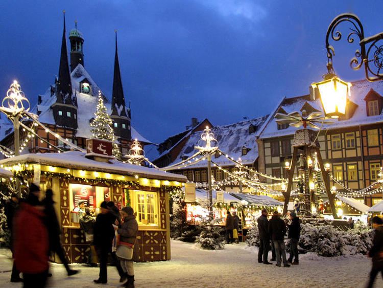
Wernigerode saxonyanhalt germany november 2013
Location
The town lies at about 250 metres above sea level (NN) on the northeastern flank of the Harz Mountains in central Germany, at the foot of their highest peak, the Brocken, on the B 6 and B 244 federal highways and on the railway line from Halberstadt to Vienenburg that links the cities of Halle (Saale) and Hanover.
The River Holtemme flows through the town and, not far from its western gate, it is joined by the Zillierbach stream, which is also known as the Flutrenne near its mouth. North of the town the Barrenbach flows through several ponds and empties into the Holtemme in the village of Minsleben. The historic town centre consists of an old town and a new town (Altstadt and Neustadt). The town's borough includes Hasserode, Nöschenrode, the residential estates of Stadtfeld, Burgbreite and Harzblick as well as the villages of Benzingerode, Minsleben, Silstedt, Schierke and Reddeber.
The borough measures 9.5 km from west to east and 6 km from north to south. Its highest point is the Brocken, at 1,141 metres above NN, and its lowest is at 215 metres.
The town lies on the German-Dutch holiday road known as the Orange Route.
The Northern Harz Boundary Fault crosses the borough along which runs the watershed between the Weser and Elbe rivers. To the north precipitation flows into the Weser, to the southeast, later northeast, waters flow into the Elbe. This fault line runs through the suburb of Hasserode to the west south west of the city centre and forms the town's castle hill to the south east of the city centre.
Town divisions
The borough of Wernigrode is divided into the town itself, including the villages of Hasserode and Nöschenrode incorporated before 1994 and five villages with their own parish councils that were integrated in 1994: Benzingerode, Minsleben, Reddeber, Schierke and Silstedt.
Climate
Wernigerode is located in the Central European transition subzone of the temperate climatic zone. Its average annual temperature is 9.5 °C; its average annual precipitation is 500 millimetres.
The warmest months are June to August with average temperatures of 16.0 to 18.3 °C and the coldest are December to February at 1.1 to 2.1 °C.
The most rain falls in July, on average 54 millimetres, the least in February, with 30 millimetres on average.
The climate, more precisely the amounts of precipitation and temperatures, are influenced by the orographic rainfall caused by the Harz Mountains. Because the town lies in the rain shadow (leeward side) of the Harz, less precipitation falls here than in similar temperate regions without the protection of a mountain range. In addition the occasional föhn winds that occur result in an increase in temperatures.
Wernigerode has a snow load class of 3 according to the German industrial standard, DIN 1055.
History
Wernigerode was the capital of the medieval County of Wernigerode and Stolberg-Wernigerode. In 1815, after the Napoleonic Wars, it became part of the Prussian Province of Saxony. The Hasseröder brewery was founded in Wernigerode in 1872.
After World War II, Wernigerode was included in the new state Saxony-Anhalt within the Soviet occupation zone (relaunched in October 1949 as the German Democratic Republic/East Germany). During the Communist years, the town was very close to the inner German border. Wernigerode became part of the restored state of Saxony-Anhalt in 1990 after German reunification.
Emergence of the town
There are no written sources confirming exactly when the town was established. According to the latest research – for example, by Eduard Jacobs and Walther Grosse – there were no early relations with the Abbey at Corvey (Weser) and the abbot there, Warin, instead the town name suggests it was a protected clearance settlement.
The first area to be settle was the Klint, where there was a lowland castle, the so-called Schnakenburg. In 1805 the ruins of this castle site were demolished. The only part remaining is Haus Gadenstedt at Oberpfarrkirchhof 12 which dates to the year 1582. At the time of the first settlelement there was still ancient forest, typical of the Harz, on the heights of the Klint, which had first to be cleared, hence the suffix -rode in the town name which means "clearing".
The town was first mentioned in the records in 1121 in connexion with Count Adalbert of Haimar who had moved here from the region near Hildesheim and henceforth was titled the Count of Wernigerode. On 17 April 1229 the settlement was granted town rights along the lines of that for Goslar. In 2004 Wernigerode celebrated the 775th anniversary of that occasion.
As a result of the immigration of new townsfolk from the surrounding villages a new settlement, later called Neustadt, grew up on the northeastern edge of the old town. It was a farming settlement that lay outside the walls of the old town. St. John's Church was built as the parish church of Wernigerode's Neustadt in the last third of the 13th century in the Romanesque style.
Mayors
Architecture
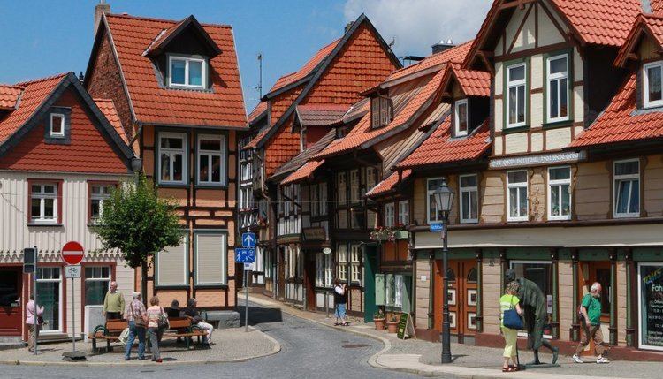
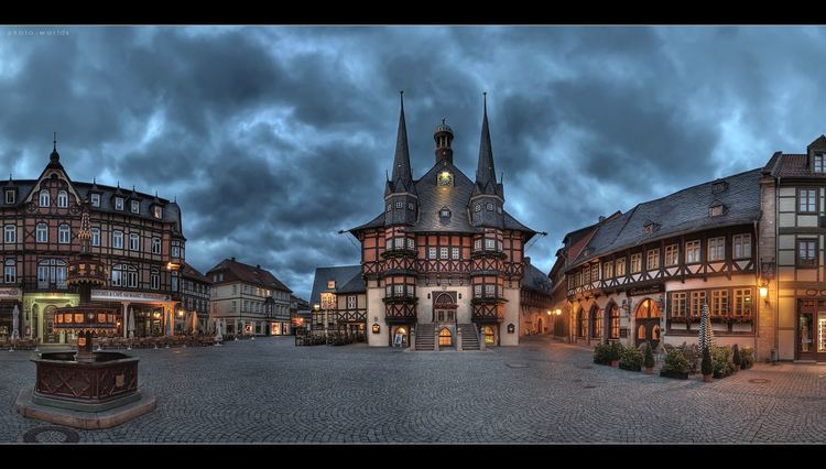
Wernigerode contains several interesting Gothic buildings, including a fine town hall with a timber facade from 1498. Some of the quaint old houses which have escaped the numerous fires through the years are elaborately adorned with wood-carving. The Gerhart-Hauptmann Gymnasium, occupying a modern Gothic building, is the successor to an ancient grammar school in existence until 1825. Brandy, Hasseröder lager, cigars and dyes are among the products manufactured in Wernigerode. The castle (Schloß Wernigerode) of the princes of Stolberg-Wernigerode rises above the town. The original was built in the 12th century but the present castle was built between 1862 and 1893 by Karl Frühling and includes parts of the medieval building.
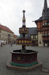
Sights
Culture
Wernigerode is the home of the choir Rundfunk-Jugendchor Wernigerode.
Natural monuments
Sport
Wernigerode hosts the Brocken Marathon each October. Wernigerode also has had an American Football club, The Mountain Tigers, since 1993. During the last 19 years this team has played in Germany's Oberliga 4 and Regionaliga 3. Since its inception, it has been a mainstay for American football in the Harz region.
International relations
Wernigerode is twinned with: