
- elevation 2,807 ft (856 m) - elevation 1,601 ft (488 m) Length 35 km Source Blue Mountains | - average 390 cu ft/s (11 m/s) Basin area 766.6 km² Basin 296 sq mi (767 km2) | |
 | ||
- location Wenaha–Tucannon Wilderness, Blue Mountains | ||
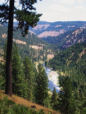
Three days on the wenaha river trail
The Wenaha River is a tributary of the Grande Ronde River, about 22 miles (35 km) long, in the U.S. state of Oregon. The river begins at the confluence of its north and south forks in the Blue Mountains and flows east through the Wenaha–Tucannon Wilderness to meet the larger river at the small settlement of Troy. A designated Wild and Scenic River for its entire length, the stream flows wholly within Wallowa County.
Contents
- Three days on the wenaha river trail
- Map of Wenaha River Oregon USA
- CourseEdit
- RecreationEdit
- References
Map of Wenaha River, Oregon, USA
CourseEdit
The source of the North Fork Wenaha River is near 46.0456°N 117.9043°W / 46.0456; -117.9043 at 5,700 feet (1,700 m) in Washington State, while the South Fork Wenaha River source is near 45.8752°N 117.9374°W / 45.8752; -117.9374 at the same elevation in Oregon. From the confluence of the forks at 2,800 feet (850 m) in the Wenaha–Tucannon Wilderness within Umatilla National Forest, the Wenaha River flows generally east through the Blue Mountains of northeastern Oregon.
In the wilderness, tributaries enter the river in the following order headed downstream: Beaver Creek, Slick Ear Creek, and Rock Creek, all from the left; Big Hole Canyon from the right; Butte Creek, left; Swamp Creek, right; Weller Creek, left; Cross Canyon, right; Fairview Creek, left; Burnt Canyon, right; Crooked Creek, left. Below Crooked Creek, the river leaves the wilderness, turns southeast and exits the national forest. Turning east again, the Wenaha River empties into the Grande Ronde River at Troy, about 45 miles (72 km) from the larger river's confluence with the Snake River.
RecreationEdit
The Wenaha River Trail, about 31 miles (50 km) long, parallels the river and its south fork between Troy and Timothy Springs, near the Union County border. Weather permitting, the trail is open for hiking and backpacking. The trail, rated "more difficult" by the United States Forest Service, varies in elevation from 1,600 feet (490 m) at Troy to 4,700 feet (1,400 m) at Timothy Springs.
Fishing along the secluded river is good. Wild rainbow trout ranging in size from 6 to 18 inches (15 to 46 cm) are abundant. Modest numbers of steelhead (seagoing rainbow trout) swim upriver from the Grande Ronde, though fishing for them is limited. Bull trout, which also frequent the river, are protected, subject to catch-and-release regulations.