
Postcode(s) 2820 Mean max temp Mean min temp Population 4,540 (2011 census) | Elevation 305 m (1,001 ft) Postal code 2820 | |
 | ||
Location 360 km (224 mi) WNW of Sydney49 km (30 mi) SE of Dubbo100 km (62 mi) N of Orange92 km (57 mi) W of Mudgee Weather 13°C, Wind W at 27 km/h, 62% Humidity | ||
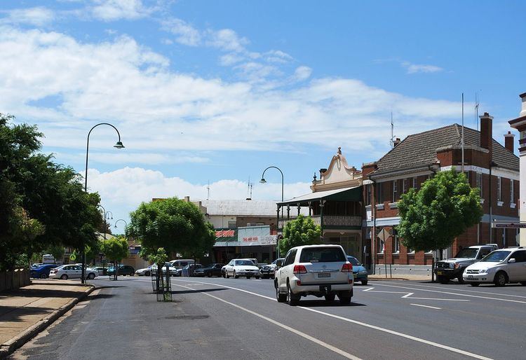
Wellington is a town in inland New South Wales, Australia, located at the junction of the Macquarie and Bell Rivers. It is within the local government area of Dubbo Regional Council. The town is 362 kilometres (225 mi) from Sydney on the Great Western Highway and Mitchell Highway. At the 2011 census, Wellington had a population of 4,540.
Contents
- Map of Wellington NSW 2820 Australia
- History
- Economy and demographics
- Climate
- Transport links
- Nearby attractions
- Notable residents
- References
Map of Wellington NSW 2820, Australia
History
The area was originally occupied by the Wiradjuri people. Explorer John Oxley was the first European to discover the area in 1817 and named it "Wellington Valley" after Arthur Wellesley, 1st Duke of Wellington.
Wellington was originally established in 1823 by Percy Simpson in early 1823 as an agricultural station. Squatters started settling along the Macquarie Valley and in 1832 CMS was established in the settlement to teach Christianity to the Aboriginal people of the area. The convict settlement ceased in 1831 but a village called Montefiores was established on the north side of the Macquarie River crossing. The Town of Wellington was gazetted in 1846. On 20 March 1885, Wellington was proclaimed a town. Wellington Shire Council was established in 1949.
Wellington is the second oldest New South Wales settlement west of the Blue Mountains. One of its hotels, the Lion of Waterloo, established by Nicolas Hyeronimus in 1842, is the oldest operating west of the Blue Mountains, and is near the location of the last recorded duel fought on Australian soil in 1854. The railway from Sydney reached Wellington in 1880.
As a regional centre Wellington benefited by the development of the gold mining industry in the district from the 1850s. Initially this was working alluvial deposits of gold but later focused on the mining of quartz reefs. Among the mining districts was Mitchells Creek located 8 miles to the north east near the locality of Bodangora.
Economy and demographics
Wellington is the centre of rich agricultural land. While alfalfa and vegetables are grown on lands on the river, wheat, wool, lambs and beef cattle are grown on surrounding pastures. In 2011, Wellington had a population of 4,540, while the population of the surrounding shire is 9200. The town acts as a commercial centre for the district.
In September 2008, the Wellington Correctional Centre was opened. A Probation and Parole Office was also opened in the centre of town. Wellington Council hopes this will stimulate economic growth in the area, due to increasing employment opportunities and the need for non-locals to utilise Wellington facilities.
The local newspaper The Wellington Times, a Rural Press title, is published three times a week with a circulation in the region of around 1000.
There is a popular Community Radio Station operating on a frequency of 91.5 MHz FM.
Climate
Wellington has a humid subtropical climate (Cfa) with hot summers and cool winters, and uniform rainfall throughout the year. The town is rather sunny, getting 138.1 clear days annually. In January, the average minimum temperature in the town is 16.9 °C and the average maximum is 32.9 °C, while in July the average minimum is 2.2 °C and the average maximum is 15.2 °C.
Transport links
Welington station is served by a daily NSW TrainLink XPT service which runs between Sydney and Dubbo.
The closest commercial airport is that of Dubbo. Qantaslink and Regional Express service the airport three-five times daily from Sydney. A small airport (Bondangora Airport) for private planes exists twelve kilometres east of Wellington.
Ogden's Coaches operates return services to Dubbo, with one extending to Narromine as a through-routed service with the Narromine link.
Nearby attractions
Lake Burrendong, a man-made lake, is located 30 kilometres south of the town. Its capacity is three and a half times that of Sydney Harbour and supplies water for irrigation schemes downstream. It is also a popular location for anglers, sailors and water skiers. Burrendong Arboretum is a sanctuary for endangered Australian flora and covers 1.60 km².
The nearby Wellington Caves feature the Cathedral Cave with the massive Altar Rock and has a viewable underground river running at the bottom. Immediately to the East of the township lies the Catombal Range with magnificent bushwalks in and around Mt Arthur and Mt Wellesley.
The Wellington Boot, a country racing festival is held in March and April annually. The Bell River Wine Estate is nearby.
Notable residents
Joseph Aarons was the first Mayor of Wellington and owned a property called Nanima; the main street of Wellington is Nanima Crescent.