
 | ||
Similar Thousand Islands, Wellesley Island State Park, Boldt Castle, Thousand Islands Bridge, Scenic View Park | ||
Wellesley island bike ride
Wellesley Island in Jefferson County, New York, United States is partially in the Town of Orleans and partially in the Town of Alexandria.
Contents
- Wellesley island bike ride
- Map of Wellesley Island New York USA
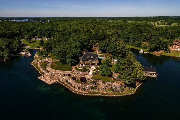
- Coldwell banker 22068 boathouse road wellesley island new york 13640
- HistoryEdit
- GeographyEdit
- Geographic featuresEdit
- Communities on the islandEdit
- Parks on the islandEdit
- References
Map of Wellesley Island, New York, USA
Coldwell banker 22068 boathouse road wellesley island new york 13640
HistoryEdit
The island was named Wells Island but renamed by Captain William Fitzwilliam Owen to the current name. There is no indication whom it was named for, but likely for Richard Wellesley, 1st Marquess Wellesley.
GeographyEdit
The island is located 44°19′N 76°00′W in the St. Lawrence River, which surrounds Wellesley Island on three sides. The island bounds an internal body of water, the Lake of the Isles, which nearly doubles its waterfront. The easternmost peninsula of the island lies across the Upper (American) Narrows from the Village of Alexandria Bay.
An arterial highway, Interstate 81, crosses Wellesley Island. Five segments composing the Thousand Islands International Bridge link the island to the opposite shores of the river. Said to be "the smallest vehicular international bridge in the world," one of the bridges crosses a narrow channel, the International Rift, which separates Wellesley Island in the United States from Hill Island in Canada. The United States border-crossing facility at the port of entry is located on the northeastern part of the island.
Wellesley, one of the largest of the Thousand Islands in the St. Lawrence River, is home to a growing number of full-time residents. Population increases dramatically during the summer months. The island has two State Parks, a nature center, and three golf courses. Located on its southern tip is the Thousand Island Park Historic District, listed on the National Register of Historic Places in 1982. In addition to Interstate 81, which connects two portions of the Thousand Islands Bridge, Jefferson County Routes 100 and 191 serve the island.