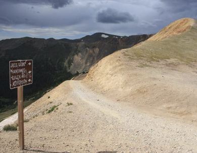
Elevation 3,689 m | Range Front Range | |
 | ||
Similar Argentine Pass, Rocky Mountains, Mosquito Pass, Kenosha Pass, Boreas Pass | ||
Webster Pass (74°34′S 111°9′W) is a snow pass in central Bear Peninsula located at the divide between Brush Glacier and Holt Glacier, on Walgreen Coast, Marie Byrd Land. Mapped by United States Geological Survey (USGS) from U.S. Navy aerial photographs taken 1966. Named by Advisory Committee on Antarctic Names (US-ACAN) in 1977 after William O. Webster, U.S. Navy aerographer on seven Operation Deepfreeze deployments, including one winter.
Map of Webster Pass, Colorado 80435, USA
This article incorporates public domain material from the United States Geological Survey document "Webster Pass" (content from the Geographic Names Information System).
References
Webster Pass Wikipedia(Text) CC BY-SA
