
Country United States County Jewell FIPS code 20-76250 Elevation 510 m Zip code 66970 Local time Sunday 11:15 AM | Time zone Central (CST) (UTC-6) GNIS feature ID 0471893 Area 28 ha Population 25 (2013) Area code 785 | |
 | ||
Weather 17°C, Wind SW at 21 km/h, 63% Humidity | ||
Webber is a city in Jewell County, Kansas, United States. As of the 2010 census, the city population was 25.
Contents
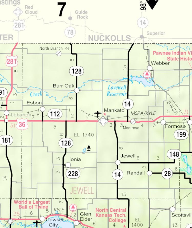
Map of Webber, KS 66970, USA
History
In 1887, Atchison, Topeka and Santa Fe Railway built a branch line from Neva (3 miles west of Strong City) through Webber to Superior, Nebraska. In 1996, the Atchison, Topeka and Santa Fe Railway merged with Burlington Northern Railroad and renamed to the current BNSF Railway. Most locals still refer to this railroad as the "Santa Fe".
The first post office in Webber was established in November 1889. The community was named for Dan Webber, an original landowner.
Geography
Webber is located at 39°56′9″N 98°2′5″W (39.935809, -98.034726). According to the United States Census Bureau, the city has a total area of 0.11 square miles (0.28 km2), all of it land.
2010 census
As of the census of 2010, there were 25 people, 13 households, and 8 families residing in the city. The population density was 227.3 inhabitants per square mile (87.8/km2). There were 27 housing units at an average density of 245.5 per square mile (94.8/km2). The racial makeup of the city was 100.0% White.
There were 13 households of which 7.7% had children under the age of 18 living with them, 61.5% were married couples living together, and 38.5% were non-families. 38.5% of all households were made up of individuals and 7.7% had someone living alone who was 65 years of age or older. The average household size was 1.92 and the average family size was 2.50.
The median age in the city was 58.8 years. 4% of residents were under the age of 18; 0.0% were between the ages of 18 and 24; 8% were from 25 to 44; 52% were from 45 to 64; and 36% were 65 years of age or older. The gender makeup of the city was 68.0% male and 32.0% female.
2000 census
As of the census of 2000, there were 37 people, 20 households, and 14 families residing in the city. The population density was 333.8 people per square mile (129.9/km²). There were 25 housing units at an average density of 225.6 per square mile (87.8/km²). The racial makeup of the city was 100.00% White.
There were 20 households out of which 10.0% had children under the age of 18 living with them, 60.0% were married couples living together, 5.0% had a female householder with no husband present, and 30.0% were non-families. 30.0% of all households were made up of individuals and 20.0% had someone living alone who was 65 years of age or older. The average household size was 1.85 and the average family size was 2.21.
In the city, the population was spread out with 10.8% under the age of 18, 16.2% from 25 to 44, 24.3% from 45 to 64, and 48.6% who were 65 years of age or older. The median age was 65 years. For every 100 females there were 131.3 males. For every 100 females age 18 and over, there were 120.0 males.
The median income for a household in the city was $25,417, and the median income for a family was $26,250. Males had a median income of $16,250 versus $23,750 for females. The per capita income for the city was $11,769. None of the population and none of the families were below the poverty line.