
Region South East England Incorporated 1 April 1974 Time zone GMT (UTC0) Non-metropolitan county East Sussex Constituent country England | Admin HQ Hailsham Area rank 42nd (of 326) Area 835 km² Sovereign state United Kingdom | |
 | ||
Status Non-metropolitan district ONS code 21UH (ONS); E07000065 (GSS) Points of interest Ashdown Forest, Seven Sisters - Sussex, Michelham Priory, Drusillas Zoo Park, Sheffield Park Garden Destinations Eastbourne, South Downs National, Royal Tunbridge Wells, Uckfield, Alfriston | ||
Wealden is a local government district in East Sussex, England: its name comes from the Weald, the remnant forest which was once unbroken and occupies much of the centre and north of this area. The term is cognate with Wald, forest or wood in German.
Contents
Map of Wealden District, UK
History
Wealden District was formed on 1 April 1974, under the Local Government Act 1972, by the merger of the Hailsham and Uckfield Rural District Councils (RDCs), both set up under the Local Government Act 1894, which also revived the parish councils.
Governance
Wealden District Council is elected every 4 years, with the Conservative party having had a majority on the council since the first election in 1973, apart from a couple of years after 1995 when no party had a majority. As of the last election in 2015 the council is composed of the following councillors:-
The district is second-level in local government, responsible for town and country planning and domestic rubbish and recycling collections, for example. There are 55 members of the Council, representing 35 wards. The towns have more than one ward: Crowborough has five; Hailsham, three; Heathfield, two; Polegate, two; and Uckfield, four. The ward boundaries are regularly redrawn in an attempt to maintain a standard number of electors per councillor. They are at 2007:
This district is entirely civil parished, enabling all farms and outlying homes to have an established community and influencing civic body, into:
Geography
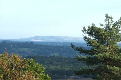
Wealden District covers two main upland areas: the section of the High Weald within East Sussex; and the eastern end of the South Downs, between which lies the Vale of Sussex, its lowlands of which are named the Pevensey Levels. The River Ouse, some of the tributaries of which originate in the district, is the border with the Lewes District; and the River Cuckmere is wholly in Wealden. The English Channel to the south is interrupted by Eastbourne. The River Rother rises on the Weald and flows easterly to the east of Rye Bay.
It is the central of the three East Sussex non-borough (low density) districts: the others being Lewes to the west, and Rother to the east.
Home ownership
The district has the highest proportion of home ownership of the 37 local authorities in Surrey, Sussex and Kent: combining the social (housing association and local authority provided) and private rented sectors, Brighton and Hove's returns recorded in 2011 that its rented sector comprised 44.4% of its housing, whereas 18.8% of Wealden's residents rented their homes. Neighbouring Rother has a marginally higher proportion of homes owned outright, 3.1% greater and a greater rented sector.
Transport
The major trunk road is the A22, London to Eastbourne; it is crossed by the A26 Maidstone–Lewes road at Uckfield; and the A267 Tunbridge Wells to Eastbourne road. There are also three west-east roads: the A259 coastal route; next inland is the A27 Pevensey–Brighton trunk road; and further to the north the A272 cross-country route to Winchester.
The East Coastway Line, serving Eastbourne and Hastings, uses the Vale of Sussex and has two station serving different sides of Pevensey in the district, which forms a generally suburban conurbation with Westham and a largely rural holiday and visitor coastline, Pevensey Bay. The other railway line is the Uckfield Branch Line from London Victoria.
Long-distance footpaths include the:
Landmarks
Major landmarks include the Seven Sisters and Cuckmere Haven along the coast; and the Long Man of Wilmington together with all of the paths over the South Downs National Park. Roman fortified hills can be found in the north of the area and Uckfield has a large architectural conservation area.
Sheffield Park Garden is an informal landscape garden now owned by the National Trust but laid out by Capability Brown. Near to this is its terminus, of the Bluebell Railway a heritage, steam railway line.
For late medieval castle construction moated Herstmonceux Castle was begun in 1440 and is study centre of Queen's University open to visitors and organising tours on a few summer days.