
Country United States Elevation 190 m Local time Sunday 12:17 PM | GNIS feature ID 454041 Area 89.69 km² Population 1,580 (2010) | |
 | ||
ZIP codes 47906, 47909, 47918, 47992 Weather 21°C, Wind S at 27 km/h, 46% Humidity | ||
Wayne Township is one of thirteen townships in Tippecanoe County, Indiana, United States. As of the 2010 census, its population was 1,580 and it contained 623 housing units.
Contents
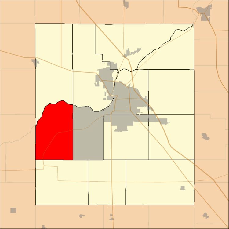
- Map of Wayne Township IN USA
- Geography
- Unincorporated towns
- Adjacent townships
- Cemeteries
- Major highways
- School districts
- Political districts
- References
Map of Wayne Township, IN, USA
Geography
According to the 2010 census, the township has a total area of 34.63 square miles (89.7 km2), of which 34.28 square miles (88.8 km2) (or 98.99%) is land and 0.35 square miles (0.91 km2) (or 1.01%) is water.
Unincorporated towns
(This list is based on USGS data and may include former settlements.)
Adjacent townships
Cemeteries
The township contains these three cemeteries: Granville, Marks and Sherry.
Major highways
School districts
Political districts
References
Wayne Township, Tippecanoe County, Indiana Wikipedia(Text) CC BY-SA