
Main source near Tuxer Alpen Length 17 km | ||
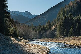 | ||
The Wattenbach or Wattenerbach has its origins in the Tux Prealps. The Mölsbach and Lizumbach streams merge in the valley bottom near Walchen Camp (Lager Walchen) at a height of 1,410 m to form the Wattenbach. It then flows from the Lizum almost due north though the Wattental valley. After 17 kilometres it empties near Wattens into the River Inn.
Contents
Map of Wattenbach, Austria
Water quality
Until the brook reaches Wattens the water has Grade A quality. The small village Wattenberg diverts their wastewater into the sewage works of the village Fritzens. The water of the Wattenbach is used for Swarovski and Watten paper. Although the water is cleaned through several sewage treatment plants the Inn River suffers from the polluted water. Only the heavy metal pollution could be reduced strongly. Several constructed defence structures have also successfully been avoiding high water.
Usage
Nine power plants use the water furthermore intensively and the water also is used by industry facilities. Therefore, sometimes very little water runs and the brook is threatened by desiccation.