
Area 7.32 km² Local time Sunday 2:40 PM Population (2014)2 2,536 | Arrondissement Dunkerque Population 2,925 (1999) Area1 7.32 km2 (2.83 sq mi) | |
 | ||
Weather 22°C, Wind S at 11 km/h, 42% Humidity | ||
Watten (Dutch: Waden, meaning "ford" as in "river-crossing") is a commune in the Nord department in northern France.
Contents
Map of 59143 Watten, France
Population (2006): 2,724 . Its inhabitants are called "Wattenais".
Geography
Watten is located at the limit of the French Flanders historical county. However, the local Dutch dialect (French Flemish) is virtually extinct. The neighbouring villages are Wattendam (commune of Holque), Millam, Serques, Éperlecques and Wulverdinghe.
While Watten belongs to the Nord département, it is bordering the Pas-de-Calais département. The village is crossed by the rivers Aa and Colme.
Sights
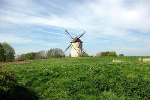
The village is famous for its old ruined abbey, and for its mill, which was restored in the 1990s. These two buildings are located on the "Mountain of Watten" (72 Meters high). Its church dates from the thirteenth century.