
OS grid reference SK500461 | Post town NOTTINGHAM Postcode district NG16 Dialling code 0115 | |
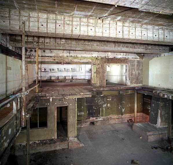 | ||
Watnall underground bunker
Watnall is an area of settlement in Nottinghamshire, England. It is part of Greasley civil parish, and is located one mile north of Kimberley. It is in the Nuthall West and Greasley (Watnall) ward of Broxtowe Council. The village is barely separated from Nuthall. Watnall Hall was built c.1690 and demolished in 1962. Even though only a village, Watnall is home to many businesses and organisations, such as British Bakeries and the Nottingham meteorological centre. There are three World War II bunkers in Watnall that served as Royal Air Force Fighter Command for the Midlands.
Contents
- Watnall underground bunker
- Map of Watnall Nottingham UK
- Ktm 450 sxf 2012 brickyard watnall mx wheeling bikelife
- References
Map of Watnall, Nottingham, UK
Ktm 450 sxf 2012 brickyard watnall mx wheeling bikelife
References
Watnall Wikipedia(Text) CC BY-SA