
Elevation 950.0 m (3,116.8 ft) | ||
 | ||
State | ||
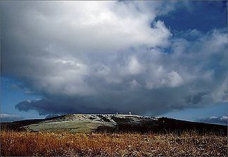
The Wasserkuppen Rhön or Wasserkuppenrhön, named after its highest peak, also the highest summit in the entire Rhön Mountains, the Wasserkuppe (950 m above sea level (NHN)), is an exposed highland ridge and natural region in the Hessian county of Fulda and Bavarian county of Rhön-Grabfeld. Together with the Long Rhön and its eastern flank it forms the Central Rhön. The Red Moor lies within this natural region.
Contents
Natural region groupingEdit
The name Wasserkuppenrhön was defined in 1968 as part of the natural regional division of Germany (M = 1:200,000) as a natural region and grouped as follows:
In the south the region is rather uniform, in the north and northwest it is dominated by foothills and isolated peaks. The land is almost treeless in the north whereas, in the south, coniferous and mixed woods form part of the landscape.
MountainsEdit
The following mountains - sorted by height in metres above sea level (NHN) lie within the Wasserkuppen Rhön: