
Surface elevation 355 m (1,165 ft) asl Catchment area 15 km² | Max. depth 24.3 m (80 ft) Catchment area 15 km² | |
 | ||
Water volume 2.0 million cubic metres (1,600 acre·ft) Similar Smiddy Shaw Reservoir, Tunstall Reservoir, Burnhope Reservoir, Hury Reservoir, Balderhead Reservoir | ||
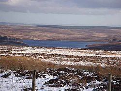
Waskerley Reservoir is the largest of a group of three reservoirs located on Muggleswick Common, County Durham, the others being Smiddy Shaw and Hisehope Reservoirs.
Map of Waskerley Reservoir, Consett, UK
The reservoir, which was constructed in 1877, is owned and operated by Northumbrian Water. It and Smiddy Shaw—which in turn is fed by Hisehope—feed water under gravity to a water treatment works at Honey Hill. Because the three reservoirs cannot meet the full demand of Honey Hill, Waskerley can be replenished by a gravity feed from Burnhope Reservoir or, if necessary, by pumping water from the Tyne-Tees Tunnel via an airshaft.
Waskerley and its two neighbouring reservoirs are located within the Muggleswick, Stanhope and Edmundbyers Commons and Blanchland Moor Site of Special Scientific Interest, which itself forms part of the North Pennines Area of Outstanding Natural Beauty.