
Country United States Borough Matanuska-Susitna Time zone Alaska (AKST) (UTC-9) Elevation 104 m Local time Saturday 8:30 PM | State Alaska Incorporated February 26, 1974 Area code 907 ZIP codes 99629, 99654, 99687 Population 8,621 (2013) | |
 | ||
Weather 7°C, Wind E at 8 km/h, 40% Humidity | ||
The drive up to independence mine above wasilla alaska dashcam
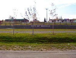
Wasilla is a city in Matanuska-Susitna Borough, United States and the sixth-largest city in Alaska. It is located on the northern point of Cook Inlet in the Matanuska-Susitna Valley of the southcentral part of the state. The city's population was 7,831 at the 2010 census. Estimates in 2013 put the population at roughly 8,621. Wasilla is the largest city in the borough and a part of the Anchorage metropolitan area, which had an estimated population of 396,142 in 2013.
Contents
- The drive up to independence mine above wasilla alaska dashcam
- Map of Wasilla AK 99654 USA
- History
- Geography
- Climate
- Demographics
- Income and poverty
- Economy
- Recreation
- Government
- Education and health
- Transportation
- Notable people
- References
Map of Wasilla, AK 99654, USA
Established at the intersection of the Alaska Railroad and Old Carle Wagon Road, the city prospered at the expense of the nearby mining town of Knik. Historically entrepreneurial, the economic base shifted in the 1970s from small-scale agriculture and recreation to support for workers employed in Anchorage or on Alaska's North Slope oilfields and related infrastructure. The George Parks Highway turned the town into a commuter suburb of Anchorage. Several state and federal agencies have offices in Wasilla, including the Alaska Departments of Environmental Conservation, Labor and Divisions of Public Assistance, Social Services.
Wasilla gained international attention when Sarah Palin, who served as Wasilla's mayor before her election as Governor of Alaska, was chosen by John McCain as his vice-presidential running mate in the 2008 United States presidential election.
Wasilla is named after Chief Wasilla, a local Dena'ina chief. "Wasilla" is the anglicized spelling of the chief's Russian-given name, Васи́лий Vasilij, which corresponds to the English name Basil.
History
Glacial ice sheets covered most of the northern hemisphere during the last glacial period, between 26,500 and 19,000–20,000 years ago, until they disappeared between 10,000 and about 7,000 years ago. Early humans moved through the area and left evidence of their passage. The Matanuska-Susitna valley was eventually settled by the Dena'ina Alaska natives who utilized the fertile lands and fishing opportunities of Cook Inlet. The Dena'ina are one of the eleven sub-groups comprising the indigenous Athabaskan Indian groups extending down Canada's western coast. The area around downtown Wasilla was known to the Dena'ina as "Benteh", which translates as "among the lakes". Russians occupied Alaska from 1741, including strategic trading posts in Lower Cook Inlet, until Alaska's sale to the United States in 1867. Near the mouth of the Matanuska River, the town of Knik was settled about 1880. In 1900, the Willow Creek Mining District was established to the north and Knik thrived as a mining settlement.
In 1917, the U.S. government planned the Alaska Railroad to intersect the Carle Wagon Road (present Wasilla-Fishhook Road) which connected Knik and the mines. Knik businesses and residents rushed to buy land nearby, and the town declined. Wasilla Station was named for the nearby Wasilla Creek. Local miners used the name "Wassila Creek", referring to Wassila, a chief of the Dena'ina. There are two sources cited for the name, one being derived from a Dena'ina word meaning "breath of air" while another stating Dena'ina derived it from the Russian name "Vasili." As Knik declined into a ghost town, Wasilla served early fur trappers and miners working the gold fields at Cache Creek and Willow Creek. More than 200 farm families from the Upper Midwest were moved into the Matanuska and Susitna valleys in 1935 as part of a U.S. government program to start a new farming community to counteract this trend; their linguistic influence is still audible in the region.
The area was a supply base for gold mines near Hatcher Pass through World War II. Until construction of the George Parks Highway around 1970, nearby Palmer was the leading city in the Matanuska Valley. Wasilla was at the end of the Palmer-Wasilla highway and the road to Big Lake provided access to land west of Wasilla. The Parks Highway put Wasilla at mile 40–42 of what became the major highway and railroad transportation corridor linking Southcentral Alaska to Interior Alaska. As a result, population growth and community development shifted from the Palmer area to Wasilla and the surrounding area. Wasilla was incorporated as a city in 1974. All non-borough municipalities throughout Alaska are designated cities.
In 1994, a statewide initiative to move Alaska's capital to Wasilla was defeated by a vote of about 116,000 to 96,000. About that time, the Matanuska Valley began to recover from an economic collapse, beginning a sustained boom that involved dramatic population growth, increased local employment, and a boom in residential and commercial real estate development. The local real estate market slowed in 2006. In 2008, suburban growth and dwindling snow forced organizers of the Iditarod Trail Sled Dog Race to bypass Wasilla permanently, due to a warming climate The race had its start in Wasilla from 1973 to 2002, the year when reduced snow cover forced a "temporary" change to Willow.
Geography
Wasilla is located at 61°34′54″N 149°27′9″W (61.581732, −149.452539).
According to the United States Census Bureau, the city has an area of 12.4 square miles (32.2 km²). 11.7 square miles (30.4 km²) of it is land and 0.7 square miles (1.8 km²) of it (5.64%) is water.
The Dena'ina (Tanaina) Native Americans called the area Benteh, meaning 'among the lakes'.
Located near Wasilla Lake and Lake Lucille, Wasilla is one of two cities in the Matanuska Valley. The community surrounds Mi. 39–46 of the George Parks Highway, roughly 43 highway miles (69.2 km) northeast of Anchorage. Nearly one third of the people of Wasilla drive the 40-minute commute to work in Anchorage every day. Six miles to the southeast is Mount POW/MIA.
Climate
Wasilla has a climate similar to that of Anchorage, but with slightly warmer daytime maxima due to its inland location. On average, over the course of the entire year, there are 30–31 days of sub-0 °F (−18 °C) lows, 37–38 days of 70 °F (21 °C)+ highs, and 1.4 days of 80 °F (27 °C)+ highs. The average annual precipitation is 17 inches (430 mm), with 52 inches (132 cm) of snowfall.
Demographics
As of the census of 2000, there were 5,469 people (up from 4,028 in 1990), 1,979 households, and 1,361 families residing in the city. The population density was 466.8 people per square mile (180.2/km²). There were 2,119 housing units at an average density of 180.9 per square mile (69.8/km²). The racial makeup of the city was 85.5% White, 0.6% Black or African American, 5.3% Native American, 1.3% Asian, 0.1% Pacific Islander, 1.3% from other races, and 5.9% from two or more races. Hispanic or Latino of any race were 3.7% of the population.
There were 1,979 households out of which 43.5% had children under the age of 18 living with them, 50.2% were married couples living together, 13.8% had a female householder with no husband present, and 31.2% were non-families. 23.5% of all households were made up of individuals and 6.8% had someone living alone who was 65 years of age or older. The average household size was 2.76 and the average family size was 3.27.
In the city, the age distribution of the population shows 33.6% under the age of 18, 10.0% from 18 to 24, 30.7% from 25 to 44, 19.0% from 45 to 64, and 6.7% who were 65 years of age or older. The median age was 30. For every 100 females there were 99.5 males; for every 100 females age 18 and over, there were 95.0 males.
The median income for a household in the city was $48,226, and the median income for a family was $53,792. Males had a median income of $41,332 versus $29,119 for females. The per capita income for the city was $21,127. About 5.7% of families and 9.6% of the population were below the poverty line, including 12.6% of those under the age of 18 and 9.7% of those 65 and older.
Income and poverty
According to the United States Census Bureau, the median household income in Wasilla from 2010 to 2014 was $62,622, with a per capita income of $28,704 and a poverty rate of 11.2% in the same year.
Economy
Wasilla began as a transportation logistics and trade center serving natural resource extraction (mining, trapping & timber) followed by small-scale agricultural activity circa 1935; around 1975, construction of the Parks Highway substantially reduced travel time to Anchorage (approximately 43 miles away), encouraging the transition to a satellite bedroom community where workers commute to Anchorage for employment. Local service employment has increased in recent years.
About 35 percent of the Wasilla workforce commutes to Anchorage. The local economy is diverse, and residents are employed in a variety of city, borough, state, federal, retail and professional service positions. Tourism, agriculture, wood products, steel, and concrete products are part of the economy. One hundred and twenty area residents hold commercial fishing permits; commercial fishermen work seasonally in Lower Cook Inlet and distant Bristol Bay or the Gulf of Alaska & Prince William Sound (there are no commercial fisheries in Upper Cook Inlet).
Recreation
The Museum of Alaska Transportation and Industry in Wasilla was established in 1967, "to give a home to the transportation and industrial remnants and to tell the stories of the people and the machines that opened Alaska to exploration and growth."
In 2010, the Menard Center lost a tenant when the Arctic Predators did not play as a member of the Indoor Football League.
Government
The Wasilla City Council is the city's legislature. It enacts laws and policy statements, sets the property tax rate, and approves the budget and funds for city services. It has six members, elected at-large by Wasilla residents for three year terms. The mayor is elected separately. A run-off election is held if no candidate for mayor receives more than 40% of the votes cast. Run-off elections are not held for city council seats. All positions are part-time.
Education and health
Wasilla is served by the Matanuska-Susitna Borough School District. It has five high schools:
There are also career training and technical colleges in Wasilla.
In January 2006 a new hospital, Mat-Su Regional Medical Center, opened. It is outside the city limits halfway between Wasilla and its twin town of Palmer.
Transportation
The George Parks Highway in conjunction with the Glenn Highway connects Wasilla to Anchorage and communities on the Kenai Peninsula. The Parks also links the Matanuska Valley to northward to the rest of the state and Canada. The Alaska Railroad serves Wasilla.
The city-owned Wasilla Airport, with a paved 3,700 foot (1,130 m) runway, provides air taxi services. The airport was formerly located in the city center before moving to a site on the western edge of the city during the 1980s. An anti-moose mat was installed around the runway in 2005, giving a light shock to animals which might otherwise wander into the path of moving aircraft. The old airport site is currently home to a city park. Wasilla also has eight public-use seaplane bases located on area lakes. Private-use air facilities registered with the FAA include 43 land-based airstrips, eight additional seaplane bases, two heliports and one STOLport.