
Existed: 1964 – present Constructed 1964 | Length 68.48 km | |
 | ||
South end OR 3 at Oregon state line near Anatone | ||
State Route 129 (SR 129) is a state highway in the U.S. state of Washington, located in Asotin County. It extends 42.55 miles (68.48 km) from Oregon Route 3 (OR 3) at the Oregon state line south of Anatone, Washington, north to U.S. Route 12 (US 12) in Clarkston, Washington.
Contents
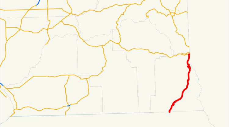
Map of WA-129, Washington, USA
SR 129 serves as a connecting road between Enterprise, Oregon and Clarkston and was originally part of Primary State Highway 3's Clarkston branch (PSH 3 DC) from 1937 until 1964, which ran from the Oregon state line to Dodge. PSH 3 DC was decommissioned in 1964, when a highway renumbering occurred, which created SR 129. SR 129 also has its own spur route located in Clarkston.
Route description
SR 129 is a highway that begins at OR 3 at the Oregon state line south of Anatone, Washington, and heads north to US 12 in Clarkston, serving as a link between the two towns. The Washington State Department of Transportation (WSDOT) found that about 9,300 motorists use the road daily beyond its intersection with Sixth Street in Clarkston based on average annual daily traffic (AADT) data.
From the Oregon state line, SR 129 travels north, then curves south before heading back north over the Grande Ronde River and going northeast past Fields Spring State Park and into the community of Anatone. After leaving Anatone, SR 129 continues northeast into Asotin. From the city, the road goes northeast as Riverside Drive and then begins to parallel the Snake River, which is the border between Washington and Idaho. Once SR 129 enters Clarkston, it breaks away from the Snake River and becomes known as 5th Street within Clarkston. After going northwest and becoming 6th Street, the road intersects SR 129 Spur and goes northeast as Diagonal Street. As Diagonal Street, the highway ends at US 12, about 0.19 miles (0.31 km) away from the Lewiston – Clarkston Bridge, which carries US 12 across the Snake River into Lewiston, Idaho.
SR 129 Spur
State Route 129 Spur (SR 129 Spur) runs 0.07 miles (0.11 km) from SR 129, north to US 12, within the City of Clarkston. The route goes from SR 129, and merges onto westbound US 12. It serves mostly as a cut through to and from the two routes and WSDOT has found that 2,300 motorists use the road daily near the SR 129 intersection.
History
SR 129 began as part of Primary State Highway 3's Clarkston branch (PSH 3 DC) in 1937. PSH 3 DC traveled from OR 3 north to Clarkston and then west to Pomeroy, ending at PSH 3 where it was co-signed with U.S. Route 295 (US 295). US 295 was established in 1926, and later decommissioned in 1967. In 1964, PSH 3 DC was renamed SR 129 and became a state highway during a statewide highway renumbering. The Washington State Department of Transportation (WSDOT) replaced the previous system of primary and secondary highways with a new system called State Routes, which is still in use today.
Major intersections
The entire highway is in Asotin County.