
Existed: 1991 – present Counties: Mason Constructed 1992 | Length 17.59 km | |
 | ||
North end FH 24 in Olympic National Forest | ||
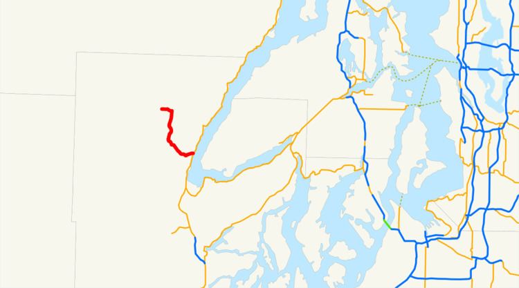
State Route 119 (SR 119) is a 10.93-mile-long (17.59 km) state highway in the U.S. state of Washington, serving Lake Cushman in Mason County within Olympic National Forest. The highway, known locally as Lake Cushman Road, travels northwest into the Olympic Mountains from U.S. Route 101 (US 101) in Hoodsport to Lake Cushman and ends at a gravel road east of the entrance to Olympic National Park on Forest Highway 24 (FFH-24). A gravel road connecting Lake Cushman to the state highway system has existed since the late 1950s and was codified into the current state highway system in 1991, prior to being completely paved by 1999.
Contents
Map of WA-119, Hoodsport, WA 98548, USA
Route description
SR 119 begins at an intersection with US 101 in the unincorporated community of Hoodsport, located on the Hood Canal in Mason County. The highway travels west along Finch Creek as Lake Cushman Road into the Olympic Mountains and passes through Hoodsport Community Trail Park, a former state park. SR 119 continues north along the coast of Lake Cushman and Big Creek into Olympic National Forest, where it begins a concurrency with FFH-24 on Staircase Road heading northwest. The concurrent highways travel west along Lake Cushman as SR 119 ends at the entrance to Olympic National Park and the end of pavement.
Every year, the Washington State Department of Transportation (WSDOT) conducts a series of surveys on its highways in the state to measure traffic volume. This is expressed in terms of average annual daily traffic (AADT), which is a measure of traffic volume for any average day of the year. In 2011, WSDOT calculated that between 340 and 2,600 vehicles per day used the highway, mostly on the shores of Lake Cushman.
History
A two-lane gravel road connecting Lake Cushman to Hoodsport was first constructed in the late 1950s as a basic gravel road, later upgraded to a paved roadway between Hoodsport and Big Creek Campground by 1965. The highway between Hoodsport and the boundary of Olympic National Park was incorporated into the state highway system in 1991 as SR 119, a child route of US 101, and the last segment between Big Creek and the park boundary was paved in 1999.
Major intersections
The entire highway is in Mason County.