
Population 321 (2011 census) Elevation 65 m Local time Sunday 8:32 AM | Postcode(s) 4307 Warrill View Wilsons PlainsRadford Postal code 4307 | |
 | ||
Weather 20°C, Wind S at 8 km/h, 74% Humidity | ||
Warrill View is a rural town in the Scenic Rim Region, Queensland, Australia. Warrill View is located in the Fassifern Valley farming area. At the 2011 Australia Census the town recorded a population of 321.
Contents
Map of Warrill View QLD 4307, Australia
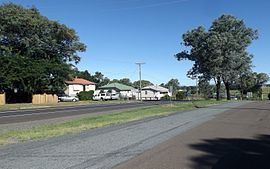
The Cunningham Highway passes through Warrill View.
History
The name Warrill comes from the name of the local creek, whose name is allegedly an Aboriginal word meaning water or stream. Warrill Creek is a tributary of the Bremer River.
Heritage listings
Warrill View has a number of heritage-listed sites, including:
References
Warrill View, Queensland Wikipedia(Text) CC BY-SA