Postcode(s) 3134 Area 2.8 km² Population 4,791 (2011 census) | Postal code 3134 | |
 | ||
Location 27 km (17 mi) from Melbourne | ||
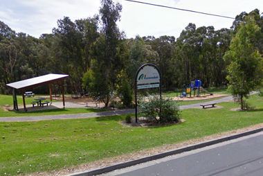
Warranwood is a suburb of Melbourne, Victoria, Australia, 27 km north-east of Melbourne's Central Business District. Its local government area is the City of Maroondah. At the 2011 census, Warranwood had a population of 4,791.
Contents
Map of Warranwood VIC 3134, Australia
Etymology
Warranwood is adjacent to Warrandyte South and Ringwood; its name is a conjunction of the two words.
Education
Two schools are located in Warranwood; Melbourne Rudolf Steiner School, on Wonga Road and Warranwood Primary School, on Wellington Park Drive.
Warranwood Primary was formerly known as Warrandyte South Primary and relocated to its current location in Term 2, 1996.
References
Warranwood, Victoria Wikipedia(Text) CC BY-SA
