
Country Poland Area 24,192 km² | Car plates N Capital Olsztyn | |
 | ||
Counties 2 cities, 19 land counties *
Elbląg
Olsztyn
Bartoszyce County
Braniewo County
Działdowo County
Elbląg County
Ełk County
Giżycko County
Gołdap County
Iława County
Kętrzyn County
Lidzbark County
Mrągowo County
Nidzica County
Nowe Miasto County
Olecko County
Olsztyn County
Ostróda County
Pisz County
Szczytno County
Węgorzewo County Website Official Voivodeship's website University University of Warmia and Mazury in Olsztyn Clubs and Teams Indykpol AZS Olsztyn, Olimpia Elbląg, Jeziorak Iława Points of interest Elbląg Canal, Castle of Warmian Bishops i, Boyen Fortress, Niedzica Castle, Wolf's Lair Destinations Olsztyn, Giżycko, Elbląg, Ełk, Frombork | ||
Warmian-Masurian Voivodeship or Warmia-Masuria Province (in Polish: Województwo warmińsko-mazurskie, [vɔjɛˈvut͡stfɔ varˈmiɲskɔ maˈzurskʲɛ]), is a voivodeship (province) in northeastern Poland. Its capital and largest city is Olsztyn. The voivodeship has an area of 24,192 km2 (9,341 sq mi) and a population of 1,427,091 (as of 2006).
Contents
- Map of Warmian Masurian Voivodeship Poland
- Cities and towns
- Administrative division
- Protected areas
- Twin towns sister cities
- References
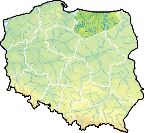
Map of Warmian-Masurian Voivodeship, Poland
The Warmian-Masurian Voivodeship was created on January 1, 1999, from the entire Olsztyn Voivodeship, the western half of Suwałki Voivodeship and part of Elbląg Voivodeship, pursuant to the Polish local government reforms adopted in 1998. The province's name derives from two historic regions, Warmia and Masuria.
The province borders the Podlaskie Voivodeship to the east, the Masovian Voivodeship to the south, the Kuyavian-Pomeranian Voivodeship to the south-west, the Pomeranian Voivodeship to the west, the Vistula Lagoon to the northwest, and the Kaliningrad Oblast (an exclave of Russia) to the north. The region contains the southern part of the historic Prussian province of East Prussia, which was divided between Poland and the Soviet Union (and hence, today Russia) after the Second World War. Following the defeat of Nazi Germany, nearly all indigenous German-speaking inhabitants were forcefully expelled by the new Soviet-appointed Polish Communist national government to what would become West and East Germany. Today, a small German-speaking minority is still present in the region.
The Warmian-Masurian Voivodeship has the largest number of ethnic Ukrainians living in Poland due to forced relocations (such as Operation Vistula) carried out by the Soviet and Polish Communist authorities.
Cities and towns
The Voivodeship contains 49 cities and towns. These are listed below in descending order of population (according to official figures for 2006):
Administrative division
Warmian-Masurian Voivodeship is divided into 21 counties (powiats): 2 city counties and 19 land counties. These are further divided into 116 gminas.
The counties are listed in the following table (ordering within categories is by decreasing population).
Protected areas
Protected areas in Warmian-Masurian Voivodeship include eight areas designated as Landscape Parks, as listed below:
The Łuknajno Lake nature reserve (part of Masurian Landscape Park) is a protected wetland site under the Ramsar convention, as well as being designated by UNESCO as a biosphere reserve.
Twin towns – sister cities
The Warmian-Masurian Voivodeship is twinned with: