
Elevation 329 m | ||
 | ||
Similar Midsummer Hill, Hergest Ridge, Caer Caradoc | ||
Wapley Hill is an Iron Age hill fort located in Herefordshire, England, 3 km south-east of Presteigne.
Contents
Map of Wapley Hill, Leominster, UK
Location
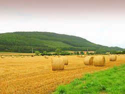
Wapley Hill stands in mixed woodland on a west-facing escarpment to the south of the B4362 road from Presteigne to Mortimer's Cross.
The Herefordshire Trail way-marked long distance footpath passes through the site.
Description
The defences stand at a height of 5.6m and occupy 6 hectares. The entrance is situated on the southern side and comprises a 90m passage.
A 'ritual shaft' dating from the late Bronze Age is sunk to a depth of 33m.
References
Wapley Hill Wikipedia(Text) CC BY-SA