
Postal code 65130 Chief Watercourse Wang Thong River Population 16,689 (2005) | Time zone ICT (UTC+7) Geocode 650808 Local time Monday 1:14 AM | |
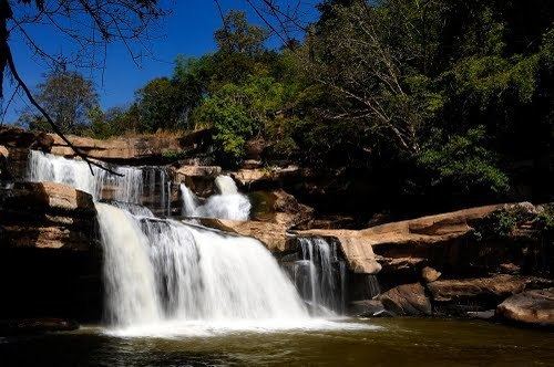 | ||
Weather 31°C, Wind S at 13 km/h, 59% Humidity Points of interest Sakunothayan Waterfall, Sakunothayan Arboretum, Pa Yang Khao Zoo | ||
Wang Nok Aen (Thai: วังนกแอ่น) is a sub-district in the Wang Thong District of Phitsanulok Province, Thailand.
Contents
- Map of Wang Nok Aen Wang Thong District Phitsanulok Thailand
- Geography
- Administration
- Temples
- References
Map of Wang Nok Aen, Wang Thong District, Phitsanulok, Thailand
Geography
Wang Nok Aen lies within the Nan Basin, which is part of the Chao Phraya Watershed.
Administration
The following is a list of the sub-district's muban, which roughly correspond to the villages:
Temples
The following is a list of Buddhist temples in the Wang Nok Aen Sub-district:
References
Wang Nok Aen Wikipedia(Text) CC BY-SA