
Elevation 80 m | ||
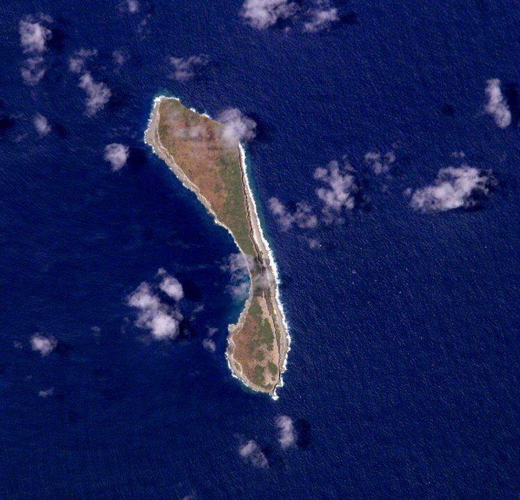 | ||
Walpole Island (French: Île de Walpole) is a small and uninhabited French island, 180 kilometres (112 miles) east of New Caledonia in the South Pacific. Although it is geographically part of the Loyalty Islands, administratively it belongs to the Isle of Pines municipality of New Caledonia.
Contents
Map of Walpole Island
History
There is evidence that the island had prehistoric inhabitants. Graves, shell and bone tools, as well as stone markers indicate the presence of a permanent population at some point. The island is the topic of several oral traditions from Maré and the Isle des Pines, the two closest inhabited islands. Speculation amongst the overseers of the Guano mining operation suggested that shipwreck or other castaways had alsooccupied the island. British captain Butler discovered the island in 1794 and named it after his ship Walpole.
From 1910 through 1936 guano was mined on the island and about 150,000 tonnes were exported to New Zealand.
The island is only visited by scientific naturalist research missions.
Geography
As the easternmost island of the Loyalty Islands arc, Walpole is located 180 km (110 mi) east of New Caledonia (168° 57' E, 22° 36' S). It is 4 km (2.5 mi) long North-South, and 0.5–1 km (0.31–0.62 mi) wide with an area of about 2.0 km2 (0.77 sq mi).
Walpole is a coral island of volcanic origin. During the last glaciation cycles, the island was submerged and rose several times, creating a coral capping. The island is bordered by eroding cliffs. On the eastern shore is a narrow plain. The island has no source of surface fresh water.