
Country Antarctica | ||
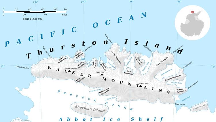 | ||
Walker Mountains (72°13′S 99°2′W) is a range of peaks and nunataks which are fairly well separated but trend east–west to form the axis, or spine, of Thurston Island. They were discovered by Rear Admiral Byrd and members of the US Antarctic Service (USAS) in a flight from the ship Bear on February 27, 1940. Named by US-SCAN for Lt. William M. Walker, captain of the United States Exploring Expedition ship Island on March 23, 1839.
Maps
This article incorporates public domain material from the United States Geological Survey document "Walker Mountains" (content from the Geographic Names Information System).
References
Walker Mountains Wikipedia(Text) CC BY-SA