
OS grid reference ST271281 Sovereign state United Kingdom Local time Friday 12:03 PM | Post town TAUNTON | |
 | ||
Weather 15°C, Wind SE at 6 km/h, 63% Humidity | ||
Walford is a small village 3 miles (5 km) north east of Taunton in Somerset, England. Most of the village, including Walford Cross at the junction of the A38 and the A361, lies in the civil parish of Creech St Michael. The western part of the village, including Walford House, is in the civil parish of West Monkton. The village lies close to the A38 and the M5 motorway.
Map of Walford, Monkton Heathfield, Taunton, UK
The place was first recorded in 682 as Wealaford.
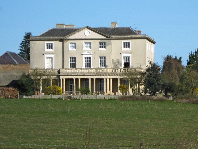
Walford House was built in the late 18th century but in 1985 was converted into flats. It is a Grade II* listed building.
Walford Farm, known as Walford Place until the 18th century, has a cruck roof which dates back to about 1600.
References
Walford, Somerset Wikipedia(Text) CC BY-SA