
OS grid reference SU972059 District Arun Local time Friday 5:12 AM | Civil parish Walberton Area 10.44 km² | |
 | ||
Population 2,174 (Civil Parish.2011) Weather 4°C, Wind N at 5 km/h, 96% Humidity | ||
Walberton is a village and civil parish in the Arun District of West Sussex, England centred five miles (8 km) north-west of Littlehampton, and south of the A27 road. The land rises from 10 metres above sea level to 35 metres, a quarter of the height of the nearest foothill, Nore Hill, of the South Downs which is outside of the parish to the north. The civil parish, administering local community buildings, fields and paths includes the smaller village of Binsted to the east and larger neighbourhood of Fontwell, less than a kilometre to the north-west. Walberton has a medieval church by its clustered village centre; Binsted's medieval church retains its original landscape setting, with village houses dispersed over the farm fields.
Contents
Map of Walberton, UK
Amenities
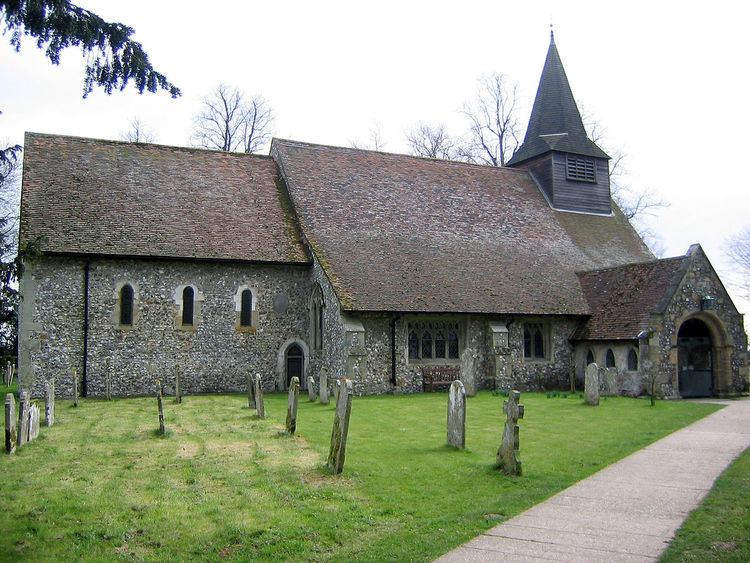
St Mary's Church in Walberton has a Saxon font and west wall. The The Holly Tree is recorded as a pub from 1845 and received its present name in 1867. Towards the end of the village there is a small duck pond. There are a few shops and a post office next to the modern village hall.
Binsted has a pub, the Black Horse and a Norman church built in AD 1140 by the monks of Tortington Priory to the immediate east. Roman and medieval pottery and tile kilns have been excavated there. Binsted also has a traditional summer festival, Strawberry Fair, where locally grown produce is sold for charity. Part of Binsted is within the South Downs National Park. The whole of Binsted's countryside was originally assessed by the Countryside Agency as meeting the criteria for inclusion.
In 2015, the community and wildlife of Binsted were being threatened by "Option B" proposals for an Arundel bypass.
Governance
An electoral ward with the name Walberton exists. This stretches north-east to Madehurst, with a total population taken at the 2011 census of 2,889.