
Country New Zealand Local time Friday 11:48 AM | Region Taranaki Population 66 (2006) | |
 | ||
District South Taranaki District Weather 17°C, Wind SE at 16 km/h, 64% Humidity Neighborhoods Nukumaru, Ngutuwera, Mangapani, Rangitatau, Orangimea | ||
Waitotara is a town in South Taranaki, New Zealand. Waverley is 10 km to the north-west, and Wanganui is 34 km to the south-east. State Highway 3 passes through it. The Waitotara River flows past the east side of the town.
Contents
Map of Waitotara, New Zealand
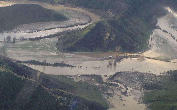
The population was 66 in the 2006 Census, a decrease of 33 from 2001. More than 30 homes were evacuated during flooding in February 2004.
A local freezing works is a major employer.
Education
Waitotara School is a coeducational full primary (years 1-8) school with a decile rating of 2 and a roll of 22. The school was founded in 1874.
References
Waitotara Wikipedia(Text) CC BY-SA