
Country New Zealand District Hastings, New Zealand | Region Hawke's Bay Local time Friday 9:21 AM | |
 | ||
Weather 16°C, Wind SW at 8 km/h, 68% Humidity | ||
Waimarama (Maori for 'moon over shining water') is a seaside village in Hastings District, Hawke's Bay, New Zealand
Contents
- Map of Waimarama 4294 New Zealand
- The Beach and Village
- SurfSwimming
- Geography
- Residents
- 2011 floods
- References
Map of Waimarama 4294, New Zealand
The Beach and Village
Many residents of Hawkes Bay, especially those in the Hastings District enjoy Waimarama as a seaside recreational beach. There is a local shop/takeaway/bottleshop and a café(Jarks)which brings beach goers from Ocean Beach, another beach a few kilometres up the coast.
Surf/Swimming
Waimarama is a popular surf beach in the area. It is known as a beach break on a sandy beach, with a rocky point. It offers both left and right handers and conditions are often suitable for surfers of all levels. Waimarama can have strong rip currents, the beach is patrolled by the Waimarama SLSC at weekends from November to March.
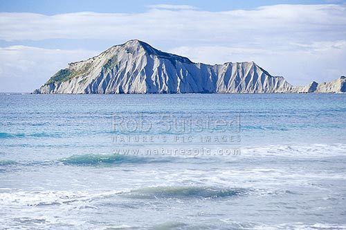
Motu-O-kura - or as English speakers know it - Bare Island/ is located just off the coast and is a popular spot for fishing and diving.
Geography
Waimarama is located at 39°S 177°E on the East Coast of New Zealand, and is sandy on the oceanfront and grassy for farmland behind the sand, this area is quite flat. The land almost immediately behind the beach is hilly and some is used for farming and some for agriculture.
Residents
Waimarama has about 240 permanent residents which is a higher population than Ocean Beach. The area has a rising number of developments; many houses that were once baches are now homes.
2011 floods
On 28 April 2011, heavy rain hit the village, causing floods and mudslides.