
Location South East Asia Highest elevation 958 m (3,143 ft) Elevation 958 m Max length 100 km | Highest point Buffalo Horn Area 3,155 km² Province West Papua | |
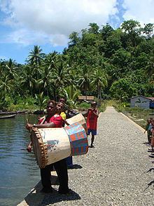 | ||
Waigeo villa raja ampat west papua
Waigeo is an island in West Papua province of eastern Indonesia. The island is also known as Amberi, or Waigiu. It is the largest of the four main islands in the Raja Ampat Islands archipelago, between Halmahera and about 65 kilometres (40 miles) to the north-west coast of New Guinea. The Dampier Strait (a.k.a. Augusta's Strait) separates it from Batanta, and the Bougainville Strait from the Kawe Islands to its north-west. The "inner sea" that nearly cleaves the island in two is the Majoli Gulf.
Contents
- Waigeo villa raja ampat west papua
- Map of Waigeo Raja Ampat Regency West Papua Indonesia
- History
- Fauna and flora
- References
Map of Waigeo, Raja Ampat Regency, West Papua, Indonesia
The area of the island is 3,155 square kilometres (1,218 square miles); the highest elevations are 958-metre-high (3,143-foot) Buffalo Horn (Gunung Nok) and 939-metre-high (3,081-foot) Serodjil. From west to east the island measures approximately 110 km, north-south about 50 kilometres (31 miles).
The town of Waisai in the west of the island is the capital of the Raja Ampat regency. Languages spoken on Waigeo include Papuan Malay, Biak, Ma'ya, and Ambel.
History
Jorge de Menezes, a Portuguese explorer, landed on Waigeo Island in 1526-27.
Alfred Russel Wallace spent some time on the island and studied the flora and fauna during the late 1850s while on his scientific exploration trip.
Since 1997, the island has been the site of a substantial pearl farming operation owned by the Australian company Atlas Pacific.