
Postcode(s) 3687 Postal code 3687 | Elevation 143 m (469 ft) Population 891 (2011 census) Local time Friday 6:06 AM | |
 | ||
Location 298 km (185 mi) NE of Melbourne51 km (32 mi) W of Wodonga9 km (6 mi) N of Rutherglen2 km (1 mi) S of Corowa Weather 9°C, Wind NE at 6 km/h, 89% Humidity Points of interest Murray to the Mountain, Pfeiffer Wines, St Leonards Vineyard | ||
Wahgunyah /wəˈɡʌnjə/ is a town in northeastern Victoria, Australia. The town is on the southern bank of the Murray River, opposite Corowa, New South Wales, in the Shire of Indigo. Wahgunyah is 298 kilometres (185 mi) north east of the state capital, Melbourne and 51 kilometres (32 mi) west of Albury/Wodonga. At the 2011 census, Wahgunyah had a population of 891.
Contents
Map of Wahgunyah VIC 3687, Australia
The name is believed to be an aboriginal phrase meaning the resting place of crows.
History
The Wahgunyah cattle run was leased by John Foord and John Crisp in 1841. The township was established by Foord in 1856 and became important before the arrival of the railway in 1879 as the furthest upstream port on the Murray. The Post Office opened on 1 July 1858 and a school opened the same year.
All Saints Estate winery to the north of town was established in 1864 by Scottish emigrants George Sutherland Smith and John Banks and its extensive cellar building was, at least in part, modelled on one of the Queen's castles, the Castle of Mey near Smith and Banks's home town Caithness.
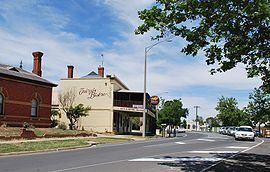
The town today
The main factory of Nestlé’s breakfast cereal arm Uncle Tobys is on the outskirts of Wahgunyah.
The town has an Australian rules football team in the Tallangatta & District Football League after having been in the Coreen & District Football League until 2007.