
Official name Waghur Dam D02985 Impounds Waghur river Total capacity 1,060 km (250 cu mi) Surface area 467 km² Location Raipur Village (Jalgaon) | Type of dam Earthfill Length 690 m (2,260 ft) Height 14 m Impound Waghur River Dam volume 70 km3 (17 cu mi) | |
 | ||
Similar Hatnur Dam, Kolkewadi Dam, Nilwande Dam, Jayakwadi Dam, Susri Dam | ||
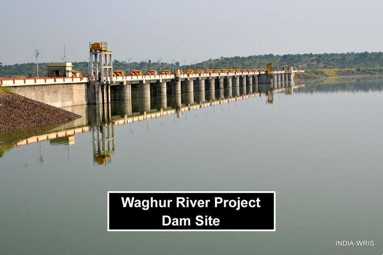
Waghur Dam is an Earthfill dam located on the Waghur River near Nandgaon, Jalgaon in the state of Maharashtra, India.
Contents
Map of Waghur Dam, Raipur, Maharashtra 425003
The dam is located on the Waghur river, which flows from its source near Ajanta and through the Khandesh region of India. Work on this major irrigation project was taken up by the Water Resources Department of Maharashtra and began construction in the year 1978. The main purpose of the dam is to supply water to Jalgaon city. Canals have been built along the left and right banks of the river to cater to the irrigation needs of local farmers. In 2006, record rainfall in the catchment area of Waghur was recorded. Nearly 40 TMC of water overflew the dam. As of 2008, the dam's reservoir has a storage capacity of 4 TMC; but with the addition of the 20 spill gates planned for the dam, the total storage capacity will be around 11.5 TMC. The project will cater to the drinking water needs of roughly 500 thousand people, and will bring irrigation water to approximately 64,000 acres (260 km2) of drought prone fields. Work on the canals on the right and left banks of the river is in progress.
Specifications
The height of the dam above its lowest foundation is 13.6 m (45 ft) while the length is 690 m (2,260 ft). It has a gross storage capacity of 50 TMC. The volume is 70 km3 (17 cu mi) and gross storage capacity is 1,220.00 km3 (292.69 cu mi).