
Car plates LWL Population 40,052 (2006) | Area 1,256 km² | |
 | ||
Gminas Total 8 (incl. 1 urban)WłodawaGmina HannaGmina HańskGmina Stary BrusGmina UrszulinGmina WłodawaGmina Wola UhruskaGmina Wyryki Points of interest Polesie National Park, Muzeum – Zespół Synagog, Włodawa Synagogue, Plaża Główna Jezioro Bi, Sobibór Museum | ||
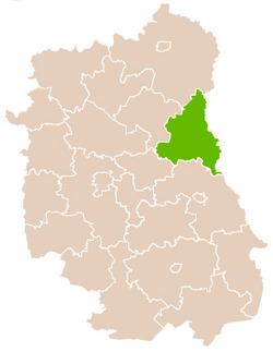
Włodawa County (Polish: powiat włodawski) is a unit of territorial administration and local government (powiat) in Lublin Voivodeship, eastern Poland, on the border with Ukraine and Belarus. It was established on January 1, 1999, as a result of the Polish local government reforms passed in 1998. Its administrative seat and only town is Włodawa, which lies 76 kilometres (47 mi) north-east of the regional capital Lublin.
Contents
Map of W%C5%82odawa County, Poland
The county covers an area of 1,256.27 square kilometres (485.0 sq mi). As of 2006, its total population is 40,052, including a population of 13,630 in Włodawa and a rural population of 26,422.
Neighbouring counties
Włodawa County is bordered by Chełm County to the south, Łęczna County and Parczew County to the west, and Biała Podlaska County to the north. It also borders Ukraine and Belarus to the east.
Administrative division
The county is subdivided into eight gminas (one urban and seven rural). These are listed in the following table, in descending order of population.