
Local time Wednesday 10:09 AM | Population 2002 9,328 | |
 | ||
Weather 13°C, Wind SW at 10 km/h, 77% Humidity | ||
Vrčin (Serbian Cyrillic: Врчин) is a suburban settlement of Belgrade, the capital of Serbia. It is located in Belgrade's municipality of Grocka.
Contents
Map of Vr%C4%8Din, Serbia
Geography
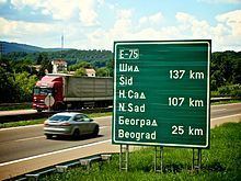
Vrčin is located southeast of Avala mountain, in the central-eastern part of the municipality, 20 km southeast of Belgrade and 14 km west of the municipal seat of Grocka. It is situated in the spring area of the Bolečica river and is a major crossroad being located on the railway Belgrade-Požarevac, the highway Belgrade-Niš, regional road connecting the highway and the road of Smederevski put (through Zaklopača) and another one connecting the highway and the Belgrade-Kragujevac road.
Neighborhoods
Vrčin has several neighborhoods of its own. They can be roughly divided into two sections, north and south of the highway.
North section:
South section:
Economy
Despite the recent development of workshops and the commercial sector (including the building of a shopping mall in the center of the settlement), the economy is mostly based on agriculture.
Politics
Vrčin was once the seat of its own municipality, which was disbanded and incorporated into the municipality of Grocka. From time to time, motions have been made proposing the separation of Vrčin from Grocka, due to the distance from its municipal seat and the fact that it is more populous than Grocka. Recent proposals have called for the split of Vrčin and several settlements from the Voždovac municipality (Zuce, Pinosava, Ripanj, Beli Potok) into a new, sub-Avalan municipality of Avalski Venac.
Population
Vrčin is statistically classified as a rural settlement (village) and officially is the second most populous settlement in the municipality (Census 2002; after Kaluđerica but ahead of the municipal seat of Grocka). However, unofficial estimates that include refugees (not counted in the official census reports) also put Leštane before Vrčin.
Vrčin extends on both sides of the highway (originally developed from the western side). The eastern extension is colloquially known asTranšped (Cyrillic: Траншпед). This area forms a continuous build-up area with Zaklopača. Vučić has experienced a steady growth of population: