
Coat of arms Flag Federal subject Komi Republic Area 29.73 km² Date formed January 4, 1936 | Country Russia Urban okrug Vorkuta Urban Okrug Local time Wednesday 6:31 AM Number of airports 1 | |
 | ||
Administratively subordinated to town of republic significance of Vorkuta Administrative center of town of republic significance of Vorkuta Weather -13°C, Wind NE at 21 km/h, 75% Humidity | ||
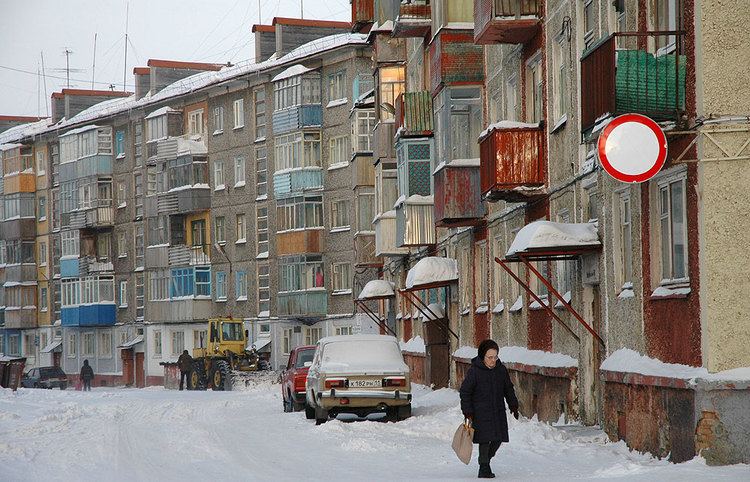
Soviet vorkuta
Vorkuta (Russian: Воркута́; Komi: Вӧркута, Vörkuta; Nenets for place teems with bears) is a coal-mining town in the Komi Republic, Russia, situated just north of the Arctic Circle in the Pechora coal basin at the Usa River. Population: 70,548 (2010 Census); 84,917 (2002 Census); 115,646 (1989 Census).
Contents
- Soviet vorkuta
- Map of Vorkuta Komi Republic Russia
- History
- Administrative and municipal status
- Economy
- Climate
- Miscellaneous
- References
Map of Vorkuta, Komi Republic, Russia
History
Industrial coal fields by the Vorkuta River were discovered in 1930 by geologist Georgy Chernov. Georgy was the son of another geologist, Alexander Chernov, who promoted the development of the Pechora coal basin, which included the Vorkuta fields. With this discovery the coal mining industry started in the Komi ASSR. At the time only the southern parts of the field were included in the Komi ASSR. The northern part, including Vorkuta, belonged to the Nenets Autonomous Okrug of Arkhangelsk Oblast. In 1931 a geologist settlement was established by the coal field, with most of the workers being inmates of the Ukhta-Pechora Camp of GULAG (Ухтпечлаг, Ukhpechlag). The origins of the town of Vorkuta are associated with one of the more notorious forced labour camps of the Gulag which was established in 1932, with the start of mining.
In 1941, Vorkuta and the labor camp system based around it were connected to the rest of the world by a prisoner-built rail line linking Konosha, Kotlas, and the camps of Inta. Town status was granted to Vorkuta on November 26, 1943. It was the largest of the Gulag camps in European Russia and served as the administrative center for a large number of smaller camps and subcamps, among them Kotlas, Pechora, and Izhma (modern Sosnogorsk). In 1953, the town witnessed a major uprising by the camp inmates.
Administrative and municipal status
Within the framework of administrative divisions, it is, together with eight urban-type settlements (Komsomolsky, Mulda, Oktyabrsky, Promyshlenny, Severny, Vorgashor, Yeletsky, and Zapolyarny) and seven rural localities, incorporated as the town of republic significance of Vorkuta—an administrative unit with the status equal to that of the districts. As a municipal division, the town of republic significance of Vorkuta is incorporated as Vorkuta Urban Okrug.
Economy
By the early 21st century many mines had closed as problems with the high costs of operation plagued the mine operators. At one time during the late 1980s and 1990s there were labor actions in the area by miners who had not been paid for a year.
Climate
Vorkuta has a subarctic climate with short cool summers and very cold and dry winters. The average February temperature is about −20 °C (−4 °F), and in July it is about +13 °C (55 °F).
Miscellaneous
The town is served by Vorkuta Airport. During the Cold War, an Arctic Control Group forward staging base for strategic bombers was located at Vorkuta Sovetsky.
One of the largest coal mine disasters in Russia occurred at Vorkuta coal mine on 28 February 2016, when leaking methane gas ignited and killed 32 people, including 26 trapped miners who had been stranded by a similar explosion 3 days prior that had killed four miners.