
Settlements 51 Time zone CET (UTC+1) Local time Tuesday 5:55 PM | Elevation 386 m (1,266 ft) Area 366 km² | |
 | ||
Weather 11°C, Wind S at 10 km/h, 85% Humidity | ||
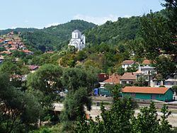
Vladičin Han (Serbian Cyrillic: Владичин Хан, [ʋlǎdit͡ʃiŋ xâːn]) is a town and municipality located in the Pčinja District of southern Serbia. The population of the town is 8,030, while the population of the municipality is 20,871. It is situated along the A1 motorway linking Belgrade with southern Serbia and ultimately with Republic of Macedonia and Greece.
Contents
Map of Vladi%C4%8Din Han, Serbia
History
From 1929 to 1941, Vladičin Han was part of the Vardar Banovina of the Kingdom of Yugoslavia.
Settlements
Aside from the town of Vladičin Han, the municipality includes the following settlements:
Demographics
According to the 2011 census results, the municipality of Vladičin Han has a population of 20,871 inhabitants.
Ethnic groups
The ethnic composition of the municipality:
References
Vladičin Han Wikipedia(Text) CC BY-SA