
Established 2002 Time zone ACST (UTC+9:30) | Postcode(s) 5223 Postal code 5223 | |
 | ||
Population 407 (shared with other localities within the “State Suburb of Vivonne Bay”) (2011 census) Region Fleurieu and Kangaroo Island | ||
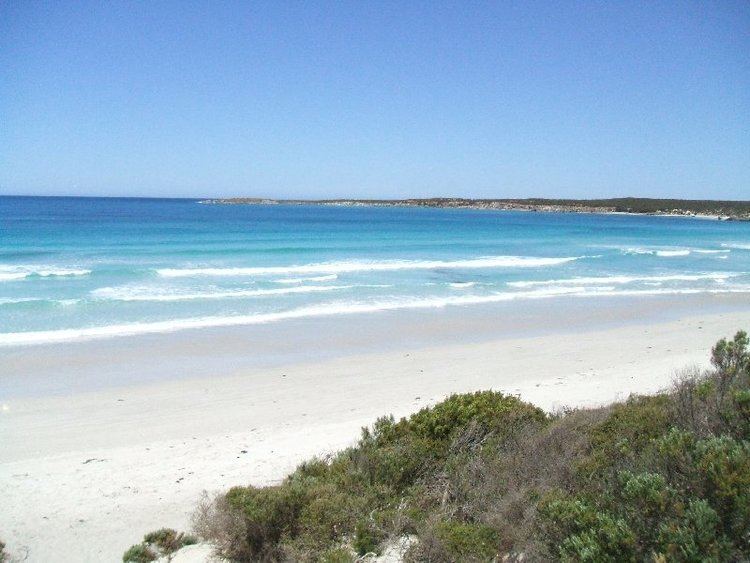
Vivonne Bay is a locality in the Australian state of South Australia located on the south coast of Kangaroo Island overlooking the body of water known in Australia as the Southern Ocean and by international authorities as the Great Australian Bight and which includes the bay known as Vivonne Bay. It is located about 174 kilometres (108 mi) southwest of the state capital of Adelaide and about 55 kilometres (34 mi) southwest of the municipal seat of Kingscote.
Map of Vivonne Bay SA 5223, Australia
Human settlement started in what is now is the locality as the town of Vivonne which was surveyed during August 1908, named after the adjoining bay and proclaimed as a government town by Governor Bosanquet on 19 May 1909. The locality’s boundaries were created in May 2002 which includes both the former government town of Vivonne and the Harriet River Shack Site, was given the “long established name” which is also derived from the adjoining bay.
Vivonne Bay is bounded by the southern coast of Kangaroo Island and includes the following coast features (from west to east) - Cape Kersaint, Point Ellen and the bay known as Vivonne Bay. Two rivers, the Harriet and the Eleanor, flow throughout the locality to discharge into the bay. A dune system known as Little Sahara is located near the locality’s eastern boundary. The South coast Road passes through the locality from west to east and connects to a settlement is located on the site of the former shack site via a side road. Facilities associated with the settlement include a general store located on the South Coast Road, an outdoor education facility operated by the Sealink Travel Group and a camping ground operated by the Kangaroo Island Council. The protected area known as the Vivonne Bay Conservation Park is located on the coastline immediately west of both Point Ellen and the bay.
The settlement was threatened in December 2007 by one of the bushfires forming part of the 2007 Kangaroo Island bushfires with the result of the evacuation of residents after South Australian Country Fire Service determined that the area was difficult to defend and the destruction of one dwelling for which residents were criticised by the acting state premier, Kevin Foley for being "foolish and reckless" for not adequately clearing vegetation around their homes.
The majority land use is agriculture with land along the coastline including the Vivonne Bay Conservation Park being zoned for conservation to “enhance and conserve the natural features of the coast”. Land associated with the former Harriet River Shack Site (now known as the ‘Harriet River Estate’ in planning documentation) is zoned for residential use.
Vivonne Bay is located within the federal division of Mayo, the state electoral district of Finniss and the local government area of the Kangaroo Island Council.