
Province Ontario | ||
 | ||
515 st laurent unit 628 viscount alexander park ottawa video tour
Viscount Alexander Park is a neighbourhood in Rideau-Rockcliffe Ward in the east end of Ottawa, Canada. At its maximum extent, the neighbourhood has a population of 5,430 according to the Canada 2011 Census.
Contents
- 515 st laurent unit 628 viscount alexander park ottawa video tour
- Map of Viscount Alexander Park Ottawa ON Canada
- References
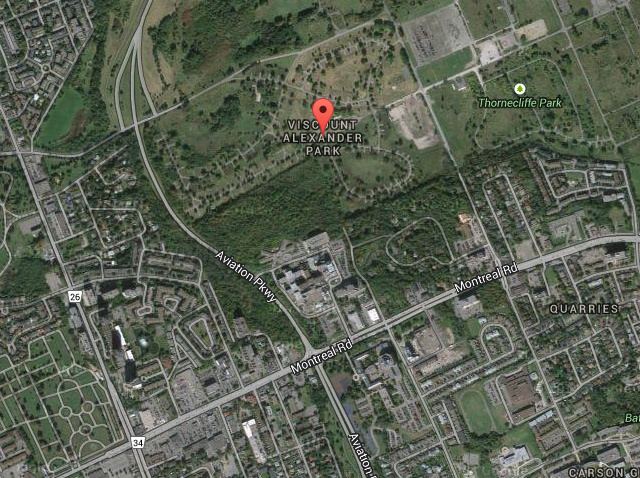
Map of Viscount Alexander Park, Ottawa, ON, Canada
The neighbourhood includes much of the Rockcliffe Airport and the CFB Ottawa (North). It also includes the Montfort Hospital.
Its bounded on the north by the Ottawa River, on the east by Blair Road, on the south by Montreal Road and on the west by St. Laurent Boulevard, Hemlock Road and the Aviation Parkway.
Part of the neighbourhood, east of Codd's Road is also known as Finter. It named for Harold, Viscount Alexander of Tunis, Governor General of Canada from 1946 until 1952.
References
Viscount Alexander Park Wikipedia(Text) CC BY-SA