
Elevation 122 m (400 ft) Vehicle registration VT Population 21,291 (2011) Postal code 33 000 | County Virovitica-Podravina Time zone CET (UTC+1) Area 178.5 km² Local time Tuesday 4:29 AM Area code +385 (0) 33 | |
 | ||
Weather 9°C, Wind N at 10 km/h, 80% Humidity | ||
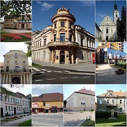
Virovitica ([ʋirɔʋǐtit͡sa]) is a Croatian city near the Hungarian border. It is situated near the Drava river and belongs to the historic region of Slavonia. Virovitica has a population of 14,688, with 21,291 people in the municipality (census 2011). It is also the capital of Virovitica-Podravina County.
Contents
- Map of 33000 Virovitica Croatia
- Name
- History
- Demographics
- Culture
- Notable people
- Twin towns Sister cities
- References
Map of 33000, Virovitica, Croatia
Name
Virovitica has also historically been known by the names Wirowititz/Virovititz and Wirowitiza (German), Viroviticza, Verewitiza, Verowitiza, Verowtiza, Verőce (Hungarian) and Varaviza (Italian), Viroviticza or Verucia Latin).
History
The town is first mentioned in 1234. It was part of Ottoman Empire between 1552 and 1684 and was kaza centre initially in Sanjak of Pojega (1552-1601), later in Sanjak of Rahoviçe in Kanije Eyalet (1601-1684) till Austrian conquest.
In the late 19th century and early 20th century, Virovitica was a district capital in the Virovitica County of the Kingdom of Croatia-Slavonia.
Demographics
The following settlements comprise the administrative area of the city of Virovitica:
Culture
The patron saint of Virovitica is St. Rocco (Sv. Rok), celebrated every August 16.
Notable people
Twin towns — Sister cities
Virovitica is twinned with: