
Canton Viriat Time zone CET (UTC+1) Population 6,083 (2011) INSEE/Postal code 01451 /01440 Department Ain | Area 45.35 km² Local time Tuesday 4:09 AM Arrondissement Bourg-en-Bresse | |
 | ||
Elevation 206–257 m (676–843 ft)(avg. 230 m or 750 ft) Weather 9°C, Wind N at 10 km/h, 82% Humidity | ||
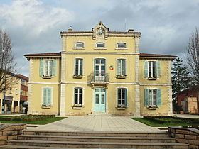
Viriat is a commune in the Ain department in the Rhône Alps of eastern France.
Contents
Map of 01440 Viriat, France
History
Settlement there goes back to at least the Celtic period.
In the twelfth century, the name "Viriacus" appears in a record, referring to church and a priory.
Twin towns
Viriat is twinned with:
References
Viriat Wikipedia(Text) CC BY-SA