
Existed: 1933 – present Counties: Russell Constructed 1933 | Length 11.01 km | |
 | ||
West end: SR 600 / SR 661 in Cleveland | ||
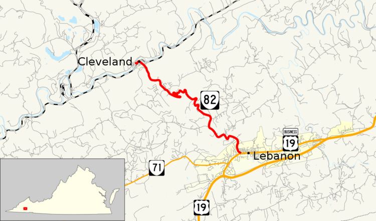
State Route 82 (SR 82) is a primary state highway in the U.S. state of Virginia. Known for most of its length as Cleveland Road, the state highway runs 6.84 miles (11.01 km) from SR 600 and SR 661 in Cleveland to U.S. Route 19 Business (US 19 Business) in Lebanon. SR 82, which provides a mountain crossing connecting the two towns in central Russell County, was established in the early 1930s.
Contents
Map of VA-82, Virginia, USA
Route description
SR 82 begins at US 19 Business (Main Street) at the west end of downtown Lebanon. The two-lane road heads northwest as Cleveland Road. The state highway crosses Glade Hollow and has a curvaceous descent of Copper Ridge. SR 82 passes through several hairpin turns on its descent into the Clinch Valley. During the descent, the state highway enters the town of Cleveland and follows a stream between two hills that are part of the Cleveland Barrens Natural Area Preserve. SR 82 heads into the center of town as Lebanon Avenue. After crossing Norfolk Southern Railway's Clinch Valley District, the state highway turns southwest onto 1st Street. SR 82 reaches its northern terminus at the north end of its bridge across the Clinch River at its intersection with SR 600 (Ivy Ridge Road) and SR 661 (Artrip Road).
History
All of SR 82 was added to the state highway system in 1932, and the number 82 was assigned in the 1933 renumbering.
Major intersections
The entire route is in Russell County.