
Existed: early 1980s – present | North end: SR 293 in Danville Length 2.08 km | |
 | ||
South end: US 29 / SR 86 in Danville | ||
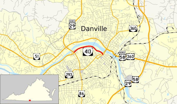
State Route 413 (SR 413) is a primary state highway in the U.S. state of Virginia. Known as Memorial Drive, the state highway runs 1.29 miles (2.08 km) from U.S. Route 29 Business (US 29 Business) and SR 86 east to SR 293 within the independent city of Danville.
Contents
Map of VA-413, Danville, VA 24541, USA
Route description
SR 413 begins at a cloverleaf interchange with US 29 Business and SR 86 west of downtown Danville. US 29 Business heads southwest along a continuation of Memorial Drive and north on Central Boulevard, which crosses over the Dan River and has another cloverleaf interchange with US 58 Business (Riverside Drive). SR 413 heads east as a four-lane divided highway, paralleling the south bank of the Dan River into the Danville Historic District. The state highway reaches SR 293 (Main Street) just south of the pair of bridges on which SR 293 crosses the river. The roadway continues as Craghead Street east toward the Danville Amtrak station. At Patton Street which carries the northbound lanes of SR 293, SR 413 ends.
Major intersections
The entire route is in Danville.