
Existed: early 1980s – present | Length 1.64 km | |
 | ||
Counties: Cities of Norfolk, Virginia Beach | ||
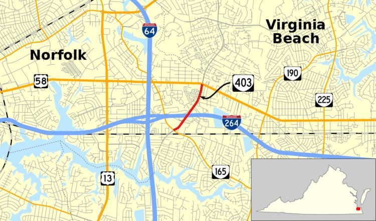
State Route 403 (SR 403) is a primary state highway in the U.S. state of Virginia. Known as Newtown Road, the state highway runs 1.02 miles (1.64 km) from SR 165 north to U.S. Route 58 (US 58). The entire road straddles the border between the independent cities of Norfolk and Virginia Beach. SR 403 connects Interstate 264 and I-64 with the state and U.S. highways as well as with the eastern terminus of the Tide Light Rail.
Contents
Map of VA-403, Virginia, USA
Route description
SR 403 begins at an intersection with SR 165 (Princess Anne Road) adjacent to the Newtown Road light rail station, which serves as the eastern terminus of the Tide Light Rail. Newtown Road continues south as an unnumbered street. The state highway heads northeast as a four-lane divided highway that closely parallels the boundary between the cities of Norfolk and Virginia Beach. SR 403 has a partial cloverleaf interchange with I-264 (Virginia Beach Expressway) that also provides access to I-64 (Hampton Roads Beltway) at the junction of the Interstate Highways just to the west of the SR 403 interchange. SR 403 reaches its northern terminus at US 58 (Virginia Beach Boulevard), from which Newtown Road continues as an unnumbered highway that enters the city of Virginia Beach.
Major intersections
The entire route is on the Norfolk / Virginia Beach line.