
Existed: 1942 – present North end: Langley AFB entrance Length 2.64 km | Counties: City of Hampton Constructed 1942 | |
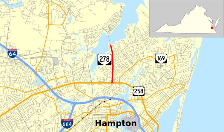 | ||
State Route 278 (SR 278) is a primary state highway in the U.S. state of Virginia. Known as King Street, the state highway runs 1.64 miles (2.64 km) from U.S. Route 258 (US 258) north to an entrance to Langley Air Force Base within the independent city of Hampton.
Contents
Map of VA-278, Hampton, VA, USA
Route description
SR 278 begins at a diamond interchange with US 258 (Mercury Boulevard). King Street continues south as an unnumbered street toward downtown Hampton. The state highway heads north as a five-lane road with center turn lane through a residential area. SR 278 loses the center turn lane at Little Back River Road and becomes two lanes at Lamington Road. The state highway gains an additional lane northbound before reaching its northern terminus at a gate for Langley Air Force Base. North of the gate, the roadway crosses the Back River to reach the main body of the military installation.
Major intersections
The entire route is in Hampton.