
Existed: 1933 – present Constructed 1933 | Length 16.01 km | |
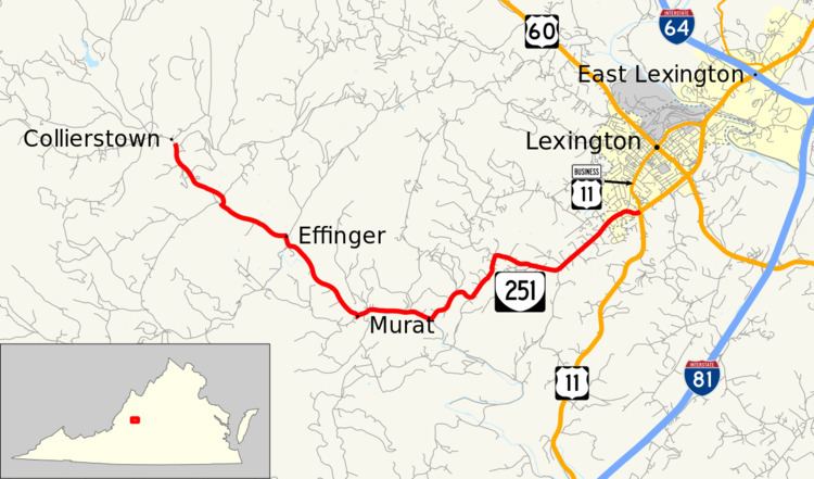 | ||
South end: SR 672 / SR 770 in Collierstown Counties: Rockbridge, City of Lexington | ||
State Route 251 (SR 251) is a primary state highway in the U.S. state of Virginia. Known for most of its length as Collierstown Road, the state highway runs 9.95 miles (16.01 km) from SR 672 and SR 770 in Collierstown north to U.S. Route 11 and US 11 Business in Lexington.
Contents
Map of VA-251, Lexington, VA 24450, USA
Route description
SR 251 begins at an intersection with Turnpike Road, which heads east as SR 672 and west as SR 770, at Collierstown in a valley southwest of House Mountain and east of North Mountain in western Rockbridge County. The state highway heads southeast as Collierstown Road along Colliers Creek, which empties into Buffalo Creek. After following the latter creek, SR 251 has a curvaceous ascent out of the stream valley. The state highway heads east into the independent city of Lexington, where the highway's name changes to Thornhill Road. When Thornhill Road veers northeast toward downtown Lexington, SR 251 continues along Link Road the short remaining distance to its northern terminus at US 11 (Lee Highway) and US 11 Business (Main Street) southwest of downtown Lexington.