
Existed: 1944 – present Counties: Fauquier Constructed 1944 | Length 5.26 km | |
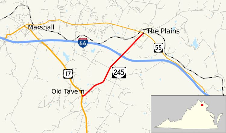 | ||
South end: US 17 / SR 703 at Old Tavern | ||
State Route 245 (SR 245) is a primary state highway in the U.S. state of Virginia. Known for most of its length as Old Tavern Road, the state highway runs 3.27 miles (5.26 km) from U.S. Route 17 (US 17) at Old Tavern north to SR 55 in The Plains in northern Fauquier County.
Contents
Map of VA-245, The Plains, VA 20198, USA
SR 245 is a Virginia Byway.
Route description
SR 245 begins at an intersection with US 17 at the hamlet of Old Tavern; the U.S. Highway heads south toward Warrenton as James Madison Highway and northwest toward Winchester as Winchester Road. The state highway heads northeast as two-lane Old Tavern Road through farmland, within which it crosses Piney Branch of Broad Run. SR 245 meets Interstate 66 at a diamond interchange south of the town of The Plains. The state highway enters town as Fauquier Avenue and reaches its northern terminus at SR 55 (Main Street).
Major intersections
The entire route is in Fauquier County.