
Existed: 1960 – present Constructed 1960 | Length 2.7 km | |
 | ||
South end: US 29 / SR 237 near Merrifield | ||
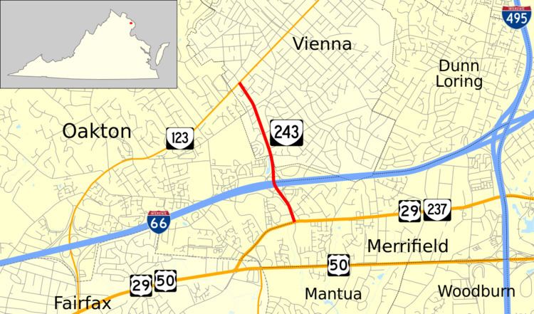
State Route 243 (SR 243) is a primary state highway in the U.S. state of Virginia. Known as Nutley Street, the state highway runs 1.70 miles (2.74 km) from U.S. Route 29 (US 29) and SR 237 near Merrifield north to SR 123 in Vienna. SR 243 connects Vienna and Fairfax with Interstate 66 (I-66) and the Vienna station of the Washington Metro.
Contents
Map of VA-243, Virginia, USA
Route description
SR 243 begins at an intersection with US 29 and SR 237 (Lee Highway) between the independent city of Fairfax and the community of Merrifield. Nutley Street continues south 0.51 miles (0.82 km) as a two-lane road designated SR 10272 to US 50 (Arlington Boulevard). SR 243 heads north as a six-lane divided highway through a cloverleaf interchange with I-66 just east of the Vienna station of the Washington Metro, which is the western terminus of the Orange Line that runs in the median of the Interstate from Vienna east to Arlington. Access to the station is provided by the first intersection on either side of the I-66 interchange. SR 243 continues into the town of Vienna as a four-lane divided boulevard that passes between residential neighborhoods before reaching its northern terminus at SR 123 (Maple Avenue) southwest of downtown Vienna. Nutley Street continues north as a two-lane residential street for four blocks to Malcolm Road.
Major intersections
The entire route is in Fairfax County.