
Existed: 1933 – present Constructed 1933 | Length 3.33 km | |
 | ||
North end: SR 633 on Gwynn's Island | ||
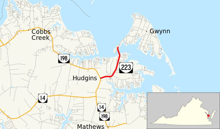
State Route 223 (SR 223) is a primary state highway in the U.S. state of Virginia. Known as Cricket Hill Road, the state highway runs 2.07 miles (3.33 km) from SR 198 at Hudgins north to SR 633 on Gwynn's Island, an island at the mouth of the Piankatank River in northeastern Mathews County.
Contents
Map of VA-223, Hudgins, VA 23076, USA
Route description
SR 223 begins at an intersection with SR 198 (Buckley Hall Road) at Hudgins. The state highway heads east and curves north through Cricket Hill. North of Cricket Hill, SR 223 crosses Milford Haven, a channel that separates Gwynn's Island from the mainland, and reaches its northern terminus at SR 633 (Old Ferry Road). SR 633 continues northeast through the island's settlements of Grimstead and Gwynn.
Major intersections
The entire route is in Mathews County.
References
Virginia State Route 223 Wikipedia(Text) CC BY-SA